Musconetcong Watershed National Water Trail
check with the trail manager for updated details before visiting.
Musconetcong Watershed National Water Trail
Nonprofit
National Water Trail
- Length
42 miles
- Elevation Gain
--
- Route Type
out & back
(1 review)
- Length
42 miles - Elevation Gain
-- - Route Type
out & back
The Musconetcong Watershed National Water Trail promotes recreational access in the Musconetcong watershed, including National Wild and Scenic River segments and Lake Hopatcong.
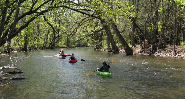
Primary Photo Musconetcong River and Kayakers. Photo by John Brunner

Photo by Eric Duch.

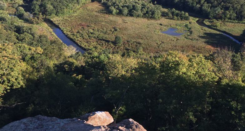
Looking down from Highlands Trail in Allamuchy. Photo by Eric Duch.

Wild and Scenic River Sign at a designated section of the Musconetcong River

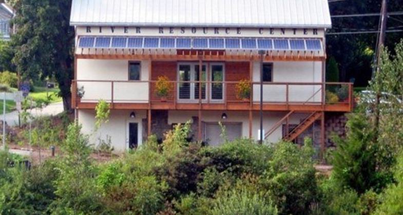
Photo of MWA's River Resource Center in Asbury, NJ

Photo of the MRMC sign in Hampton

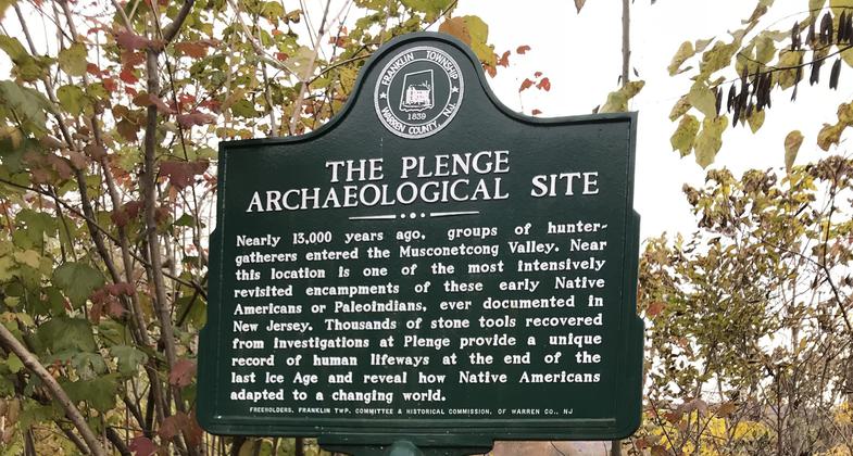
Photo of the interpretive sign for the Plenge site

Photo of the Hughesville Dam sign

Photos from MWA's River Watcher Program

MWA River Cleanup's Lake Hopatcong team
Location: Information kept at Musconetcong Watershed Association River Resource Center, 10 Maple Avenue, Asbury, NJ 08802
- States: New Jersey
- Counties: Sussex, Morris, Hunterdon, Warren
- Cities/Townships: Allamuchy, Byram, Independence, Hackettstown, Mansfield, Washington, Lebanon, Franklin, Hampton, Bethlehem, Bloomsbury
Located in Northwestern New Jersey, the Musconetcong watershed provides a much-needed opportunity for recreating natural, historic, and agricultural landscapes in a metropolitan area where 20 million people live. The watershed is popular for boating, fishing, hunting, hiking, wildlife viewing, scenery, and outdoor photography all characteristics which contributed to the Musconetcong River's designation as a National Wild and Scenic River in 2006. The Musconetcong River begins at Lake Hopatcong (New Jersey's largest lake) and runs 42 miles down to the Delaware River. Surrounded by rugged Highland ridges, the river flows by state and county parks, historic hamlets, nature preserves, and one of the region's most scenic agricultural valleys.
The Water Trail route utilizes established public access points that accommodate a diversity of trip lengths and levels of difficulty. The 10 trip segments provide access to a variety of opportunities for recreation and education, ranging from flat water to segments requiring advanced paddling skills. The trip segments range from four to 12 miles or longer as several river segments are contiguous and overnight camping is allowed only at Stephens State Park. There are many public access points along the Musconetcong, so it is possible to plan a variety of shorter or longer river trips.
Much of Northwestern New Jersey's history is visible from its waterfronts. Waterways have been critical to the region's inhabitants for food, transportation, and power. Human habitation along the Musconetcong River began over 10,000 years ago when Paleo-Indians camped along the river's glacial waters. The Lenape Indians planted corn in the rich limestone river valley, and no doubt canoed down the river they named Musconetcong, or rapid running stream. The European settlers displaced the Lenape during the early eighteenth century and built their mills and villages along the river. By the early nineteenth century, the Musconetcong Valley was one of New Jersey's most important iron-producing and agricultural regions, supplying both the New York and Philadelphia markets. The Musconetcong River flows through seven Historic Districts and under numerous metal truss and stone arch bridges listed on the National Historic Register.
Historically, transportation over the Highlands was poor. The Morris Canal, now a National Landmark, overcame these obstacles with inclined planes and a series of locks, some of which parallel the river and Lake Hopatcong and at Waterloo Village. Later, railroads connected the region's agriculture and industry to major shipping ports. The railroads also enticed city residents for visits to the country, Bertrand Island's amusement park in Lake Hopatcong, and peach picking in the Musconetcong Valley. Along the river are several former grist mills, remnant dams, and stone railroad bridge piers that remind us of this past, as these waterways are restored for wildlife habitat and opened for recreational use and sightseeing.
The Water Trail is maintained by the Musconetcong Watershed Association, in partnership with Lake Hopatcong Foundation, and the Musconetcong River Management Council. The Musconetcong Watershed is the focus of several education and water quality improvement programs. Notably, several obsolete dams have been removed on the Musconetcong River, and have opened 6 miles of free-flowing river to the Delaware River and allowed migratory fish, like American Shad, to return. Visit www.musconetcong.org to learn more about the Water Trail, education opportunities, organized trips, and river restoration. Learn more about Lake Hopatcong at www.lakehopatcongfoundation.org and other regional tourism opportunities at Scenic, Wild Delaware River: www.delawareriver.natgeotourism.com.
Accessibility Information
No text provided.
Reviews
Bill Woolley
Great trail!
Spectacular scenes with a wonderful variety of lakes and waterways to navigate along 42 miles. I'm partial to the Lake Musconetcong section in Stanhope, which once accommodated the historic Morris Canal. This is the New Jersey that not enough people see, know about, or fully appreciate.
Allowed Uses:
Boating, human-powered SwimmingOther Activities
- Fishing
- Heritage and history
- Hunting
- Wildlife viewing / observation
Public Contact
Charlie FineranMusconetcong River Management Council
P.O. Box 113
Asbury, NJ 08802
(908) 537-7060
More Details
- Elevation (low): --
- Elevation (high): --
- Elevation (cumulative): --
- Part of a Trail System? No
- National Designations: Partnership Wild & Scenic River
- Surface (primary): --
- Surfaces (additional): Rock, boulders, Rock, smooth, Snow or ice, Water, calm
- Tread Width (average): 0"
- Tread Width (minimum): 0
- Running length (minimum): --
- Tread Grade (average, percent): --
- Tread Grade (maximum):
- Running length (maximum): --
- Cross-slope (average, percent): 0
- Cross-slope (maximum): --
- Running length (maximum): --
- Certified as an NRT
Oct 25, 2020


