Naha River Trail
check with the trail manager for updated details before visiting.
Naha River Trail
USDA Forest Service
Backcountry Trail
- Length
5.4 miles
- Elevation Gain
--
- Route Type
out & back
(1 review)
- Length
5.4 miles - Elevation Gain
-- - Route Type
out & back
This scenic and popular trail begins on saltwater and parallels the shoreline of Roosevelt Lagoon for about 2 miles.

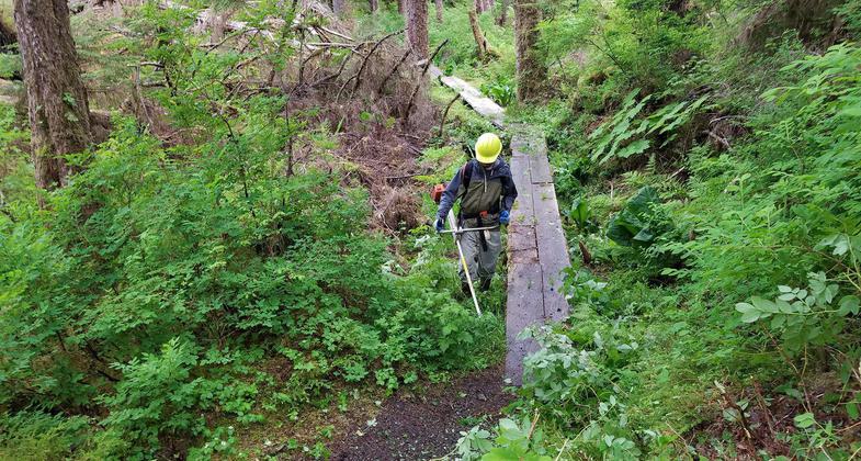
An all-hands field day to perform maintenance on a section of the Naha River Trail. Photo by USFS.
Location: Near Ketchikan at Naha Bay.
- States: Alaska
- Counties: Ketchikan Gateway
The trail varies from a nearly flat boardwalk over the lower 2.5 miles to a moderately steep grade for the next four miles to Heckman Lake.
June through September are the most popular hiking months in southeast Alaska. Upper elevations are often snow-covered until mid-June, making the going tough without skis or snowshoes. A clear fall day, without bugs and with autumn alpine colors, can be a great time for a trip, providing you are prepared for sudden weather changes.
Accessibility Information
No text provided.
Reviews
Richard Walker
Two years ago in August.
My brother and I were staying in the Jordan Lake cabin. We had been there 5 years previously and had hiked as far as Orton ranch while fishing the river. We found the trail to be in generally good condition. Two years ago, it was in pretty rough condition; over grown in some areas and the board walks were in need of a lot of repair. Still, all in all, a beautiful hike. We plan to go again in the next year or so and hope to hike it several times to our favorite fishing spot.
Allowed Uses:
Hiking/WalkingPublic Contact
Denise WolvinTongass National Forest
3031 Tongass Ave.
Ketchikan, AK 99901
[email protected] • 907-228-4134
Contact the trail manager for current maps and visiting details.
More Details
- Elevation (low): --
- Elevation (high): 150
- Elevation (cumulative): --
- Part of a Trail System? No
- Surface (primary): Boardwalk
- Surfaces (additional): Boardwalk, Rock, crushed
- Tread Width (average): 36"
- Tread Width (minimum): --
- Running length (minimum): --
- Tread Grade (average, percent): --
- Tread Grade (maximum): 20
- Running length (maximum): --
- Cross-slope (average, percent): --
- Cross-slope (maximum): --
- Running length (maximum): --
- Certified as an NRT
Dec 7, 1978

