Nassau-Suffolk Greenbelt
This information is a public record of the 1993 NRT application and may be out of date if it has not been updated by a trail manager --
check with the trail manager for updated details before visiting.
check with the trail manager for updated details before visiting.
Nassau-Suffolk Greenbelt
City, Town, or County
Frontcountry Trail
- Length
22 miles - Elevation Gain
-- - Route Type
out & back
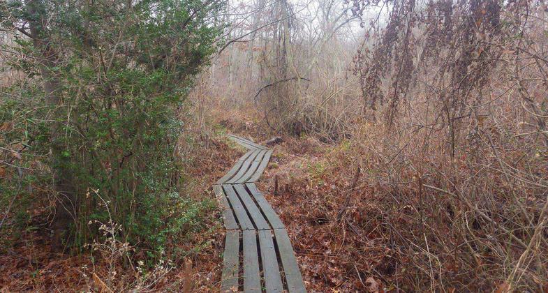
From steep hills to old fields to quiet wetlands, this 20-mile National Recreation Trail offers surprising diversity. From Cold Spring Harbor, where mountain laurels bloom in June, the trail crosses Long Island to Massapequa Preserve watershed, where dozens of species of birds stop on their fall and spring migrations. Paths for mountain bikers parallel parts of this trail, and a loop in the Plainview area provides a connection with the Walt Whitman Trail.
Location: Suburban
- States: New York
- Counties: Nassau, Suffolk
CAUTION: Trails are maintained as hiking trails only unless marked as suitable for multi-use. Public schedule of 100 led hikes/year.
Accessibility Information
No text provided.
Allowed Uses:
Bicycling Dogs, on leash Hiking/Walking Snow, cross-country skiingOther Activities
- Fishing
- Snow, snow play general
- Wildlife viewing / observation
Public Contact
James Van TassellLong Island Greenbelt Trail Conference
Long Island Greenbelt Trail Conference, Inc
Hauppauge, NY 11788
james.vantassell@osrtrails.org • (631) 360-0753
ligreenbelt.org
Contact the trail manager for current maps and visiting details.
More Details
- Elevation (low): --
- Elevation (high): 321
- Elevation (cumulative): --
- Part of a Trail System? No
- Surface (primary): Soil
- Surfaces (additional): Boardwalk, Grass or Vegetation, Wood chips/mulch
- Tread Width (average): 36"
- Tread Width (minimum): --
- Running length (minimum): --
- Tread Grade (average, percent): --
- Tread Grade (maximum): 17
- Running length (maximum): --
- Cross-slope (average, percent): --
- Cross-slope (maximum): --
- Running length (maximum): --
- Certified as an NRT
Jan 10, 1993


