Nez Perce - Nee Me Poo
This information is a public record of the 1979 NRT application and may be out of date if it has not been updated by a trail manager --
check with the trail manager for updated details before visiting.
check with the trail manager for updated details before visiting.
Nez Perce - Nee Me Poo
USDA Forest Service
Backcountry Trail
- Length
5 miles
- Elevation Gain
--
- Route Type
out & back
- Length
5 miles - Elevation Gain
-- - Route Type
out & back

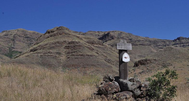
Along the Nez Perce National Historic Trail, in the Hells Canyon National Recreation Area. Photo by USFS.

Along the Nez Perce National Historic Trail, Dug Bar on the Snake River in the Hells Canyon National Recreation Area. Photo by USFS.
Location: In Hell's Canyon National Recreation Area NE of Imnaha. Trail descends to Dug Bar on the Snake River.
- States: Oregon
- Counties: Wallowa
The trail travels across the corner of Hells Canyon National Recreation Area, which includes Hells Canyon, the deepest Canyon in North America. With a diverse and rugged terrain, the area is rich in historic and prehistoric cultural areas. Opportunities to view prickly pear cactus, elk, big horn sheep, and mule deer occur at many sections of the trail.
Accessibility Information
No text provided.
Allowed Uses:
Dogs, on leash Hiking/WalkingOther Activities
- Camping
Public Contact
Wallowa Mountains Office, (541) 426-5546
Contact the trail manager for current maps and visiting details.
More Details
- Elevation (low): 1005
- Elevation (high): 2690
- Elevation (cumulative): --
- Part of a Trail System? No
- Surface (primary): Soil
- Surfaces (additional): --
- Tread Width (average): 18"
- Tread Width (minimum): --
- Running length (minimum): --
- Tread Grade (average, percent): 5
- Tread Grade (maximum): 30
- Running length (maximum): --
- Cross-slope (average, percent): --
- Cross-slope (maximum): --
- Running length (maximum): --
- Certified as an NRT
Oct 4, 1979

