Noble Canyon
check with the trail manager for updated details before visiting.
Noble Canyon
USDA Forest Service
Backcountry Trail
- Length
10 miles
- Elevation Gain
--
- Route Type
out & back
- Length
10 miles - Elevation Gain
-- - Route Type
out & back
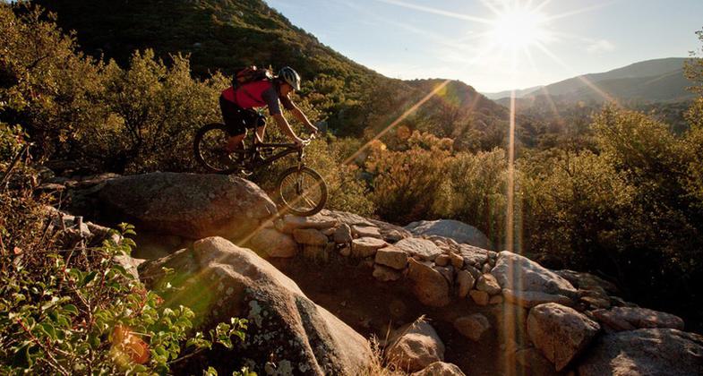
With three distinct topography ranges, Noble Canyon is one of the few areas to offer vast Anza Borrego Desert views, wide stretches of open meadows, and crisp air atop the Laguna Mountain, all while touring shrub-covered backcountry, jagged peaks, and an abundance of wildlife activity.
Location: The Noble Canyon National Recreation Trail begins along Pine Creek Road north of the community of Pine Valley. It terminates at the Pacific Crest Trail near Oasis Spring in the Laguna Mountain Recreation Area.
- States: California
- Counties: San Diego
With three distinct topography ranges, Noble Canyon is one of the few areas to offer vast Anza Borrego Desert views, wide stretches of open meadows, and crisp air atop the Laguna Mountain, all while touring shrub-covered backcountry, jagged peaks, and an abundance of wildlife activity.
An hour's drive from San Diego proper, this solitude-inducing day trip provides more than a killer leg workout, it is also hailed as one of the premier riding destinations in the country, making it a popular destination for mountain bikers everywhere.
Noble Canyon stands as one for the more ambitious rider or hiker, with nearly 10 miles (one way) of ledge-hugging switchbacks, steep slopes, and jagged rocks, finishing the ride can occasionally require some walking. Noble Canyon intersects the Big Laguna, Sunset, and Pacific Crest Trails extending to the El Prado Campground, Laguna, and Burnt Rancheria Campgrounds (depending on your starting and ending location) for the outdoor and overnight enthusiast.
With its intense incline, steep slopes, and heavy rock coverage, the trail can be very technical and challenging, reserved for the more advanced or adventurous rider. The elevation can change from 3700 to 5500 and certain sections, like the one known as "Stairway to Hell," require good speed and weight distribution, making the battle between skill and fitness an interconnecting element imperative to the trek forward. While Noble Canyon demands much from the recreational user, intermediate riders need not be scared off. Though certain sections require some finesse, those who don't frown on a little walking and are up to the challenge should be able to complete it.
Completing the entire loop from Big Laguna to Noble Canyon and back spans approximately 30 miles.
Accessibility Information
No text provided.
Allowed Uses:
Bicycling Dogs, on leash Equestrian Hiking/Walking Snow, cross-country skiing Snow, snowshoeingOther Activities
- Camping
- Fishing
- Snow, snow play general
- Wildlife viewing / observation
Public Contact
Anne CareyCleveland National Forest
Descanso Ranger District
Alpine, CA 91901
[email protected]
Contact the trail manager for current maps and visiting details.
More Details
- Elevation (low): 3740
- Elevation (high): 5420
- Elevation (cumulative): --
- Part of a Trail System? No
- National Designations: National Millennium
- Surface (primary): Soil
- Surfaces (additional): --
- Tread Width (average): 24"
- Tread Width (minimum): --
- Running length (minimum): --
- Tread Grade (average, percent): 4
- Tread Grade (maximum): 12
- Running length (maximum): --
- Cross-slope (average, percent): --
- Cross-slope (maximum): --
- Running length (maximum): --
- Certified as an NRT
Mar 28, 1982


