North Fork John Day
This information is a public record of the 1979 NRT application and may be out of date if it has not been updated by a trail manager --
check with the trail manager for updated details before visiting.
check with the trail manager for updated details before visiting.
North Fork John Day
USDA Forest Service
Backcountry Trail
- Length
22.9 miles - Elevation Gain
-- - Route Type
out & back
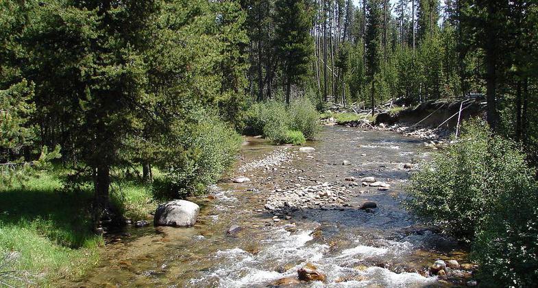
This 22.9 mile trail travels east along along the Wild and Scenic North Fork John Day River.
Location: North Fork John Day Ranger District, Umatilla National Forest
- States: Oregon
- Counties: Umatilla, Grant
This trail begins at North Fork John Day Trailhead within the Campground. This 22.9 mile trail travels east along along the Wild and Scenic North Fork John Day River within North Fork John Day Wilderness and ends at Oriental Creek Trailhead on Forest Service Road 5506. This trail is popular for its fishing, hunting, hiking, and pack and saddle recreation opportunities.
Accessibility Information
No text provided.
Allowed Uses:
Swimming Dogs, on leash Equestrian Hiking/Walking Snow, cross-country skiing Snow, snowshoeingOther Activities
- Camping
- Caving
- Fishing
- Snow, snow play general
- Wildlife viewing / observation
Public Contact
David GuglielmiUmatilla National Forest
North Fork John Day Ranger District
Ukiah, OR 97880
dguglielmi@fs.fed.us • (541) 227-5326
www.fs.fed.us/r6/uma
Contact the trail manager for current maps and visiting details.
More Details
- Elevation (low): 3300
- Elevation (high): 5500
- Elevation (cumulative): --
- Part of a Trail System? No
- Surface (primary): Soil
- Surfaces (additional): Soil
- Tread Width (average): 18"
- Tread Width (minimum): --
- Running length (minimum): --
- Tread Grade (average, percent): 5
- Tread Grade (maximum): 10
- Running length (maximum): --
- Cross-slope (average, percent): --
- Cross-slope (maximum): --
- Running length (maximum): --
- Certified as an NRT
Oct 18, 1979


