Northern Delaware Greenway Trail - Brandywine Creek
check with the trail manager for updated details before visiting.
Northern Delaware Greenway Trail - Brandywine Creek
State
Backcountry Trail
- Length
2.5 miles
- Elevation Gain
--
- Route Type
out & back
- Length
2.5 miles - Elevation Gain
-- - Route Type
out & back
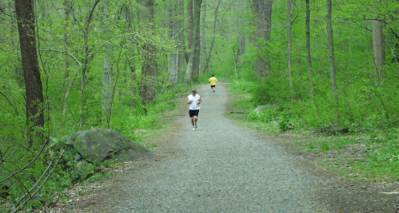
The Brandywine Trail is a regional transportation and recreational asset. Brandywine Creek State Park plays an important role in connecting recreational, historic, and natural resources, while providing the community with a safe place to be active. Trail users can catch glimpses of the Brandywine River, view unique geologic features, experience Piedmont wooded landscapes, spring wildflowers, and wildlife.
Location: Running north-south on the eastern side of the Brandywine Creek in Brandywine Creek State Park, Delaware.
- States: Delaware
- Counties: New Castle
- Cities/Townships: Wilmington
The Brandywine Trail is a regional transportation and recreational asset. Brandywine Creek State Park plays an important role in connecting recreational, historic, and natural resources while providing the community with a safe place to be active. Trail users can catch glimpses of the Brandywine River, view unique geologic features, and experience Piedmont wooded landscapes, spring wildflowers, and wildlife.
The purpose of the Brandywine Trail is to help protect water quality, safeguard historic and cultural resources, improve air quality, maintain plant and animal biodiversity, sustain and enhance Delaware's scenic beauty, and provide space for recreation and active transportation. The trail serves many people in the greater Wilmington area, giving residents in nearby neighborhoods easy access to parkland.
Trail stewards serve an important role in maintaining the Brandywine Trail. The trail stewards are the eyes and ears for the trail managers. They assist trail users with directions and advice, promote the use of the trail, report trail conditions, and assess visitor needs and safety concerns. All trail stewards are volunteers and they choose their own time to perform their service. In return, they receive an identification badge, gear, and free entrance into all Delaware State Parks.
This trail is wide on a gentle grade with a crushed stone surface. Trail users can catch glimpses of the Brandywine River, view unique geologic features, and experience Piedmont wooded landscapes, spring wildflowers, and wildlife. The trail passes under Thompsons Bridge Road and continues north eventually onto lands owned by the First State National Monument. Aside from hiking, trail users can experience picnicking, fishing, and canoeing along Brandywine Creek.
Accessibility Information
No text provided.
Allowed Uses:
Bicycling Dogs, on leash Equestrian Hiking/WalkingOther Activities
- Wildlife viewing / observation
Public Contact
Avery DunnDelaware State Parks
DE
[email protected] • (302) 739-9207
Contact the trail manager for current maps and visiting details.
More Details
- Elevation (low): 3
- Elevation (high): 290
- Elevation (cumulative): --
- Part of a Trail System? No
- National Designations: East Coast Greenway
- Surface (primary): Rock, crushed
- Surfaces (additional): Paved
- Tread Width (average): 120"
- Tread Width (minimum): 50
- Running length (minimum): --
- Tread Grade (average, percent): 5
- Tread Grade (maximum): 15
- Running length (maximum): --
- Cross-slope (average, percent): 5
- Cross-slope (maximum): --
- Running length (maximum): --
- Certified as an NRT
May 29, 2013


