Northshore Trail
check with the trail manager for updated details before visiting.
Northshore Trail
U.S. Corps of Engineers
Backcountry Trail
- Length
19 miles
- Elevation Gain
--
- Route Type
Loop
- Length
19 miles - Elevation Gain
-- - Route Type
Loop
Location: Joins Rock Ledge and Murrell Parks along the N shore of Grapevine Lake.
- States: Texas
- Counties: Denton
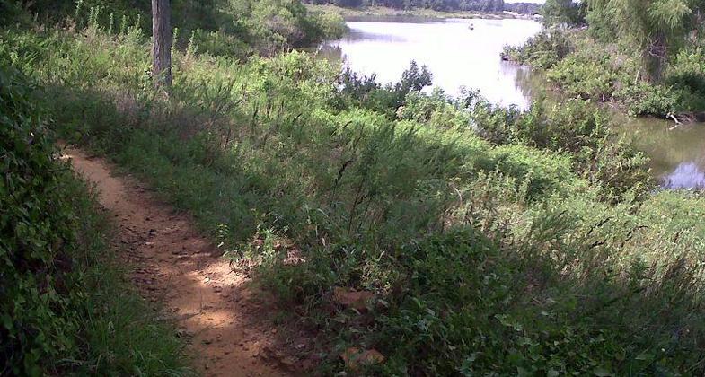
This single-track one-way loop with a natural surface that has trailheads in Rockledge, Murrell, and Twin Coves Parks. Various wildlife such as rabbits, foxes, and waterfowl may be seen from the trail as it winds along the lake shore. The eastern half is less technical than the western and is better suited to novice riders. Drinking water is available at all trailheads, with restrooms located at Rockledge Park and Murrell Park only.
Particularly in the area of Twin Coves, the trail is very rocky and has varied terrain. For the easiest access, especially on weekends, trail users are advised to access the trail in Murrell Park.
Accessibility Information
No text provided.
Allowed Uses:
Bicycling Hiking/WalkingPublic Contact
Tim MusickUS Army Corps of Engineers
110 Fairway Dr.
Grapevine, TX 76051
[email protected] • (817) 865-2600
www.swf-wc.usace.army.mil/grapevine/Recreation/Trails/Bike.a
Contact the trail manager for current maps and visiting details.
More Details
- Elevation (low): --
- Elevation (high): --
- Elevation (cumulative): --
- Part of a Trail System? No
- Surface (primary): --
- Surfaces (additional): --
- Tread Width (average): 48"
- Tread Width (minimum): --
- Running length (minimum): --
- Tread Grade (average, percent): --
- Tread Grade (maximum):
- Running length (maximum): --
- Cross-slope (average, percent): --
- Cross-slope (maximum): --
- Running length (maximum): --
- Certified as an NRT
Aug 19, 1991


