Oak Leaf Trail - Warnimont Park
This information is a public record of the 1973 NRT application and may be out of date if it has not been updated by a trail manager --
check with the trail manager for updated details before visiting.
check with the trail manager for updated details before visiting.
Oak Leaf Trail - Warnimont Park
City, Town, or County
Urban Trail
- Length
1.5 miles
- Elevation Gain
--
- Route Type
out & back
- Length
1.5 miles - Elevation Gain
-- - Route Type
out & back
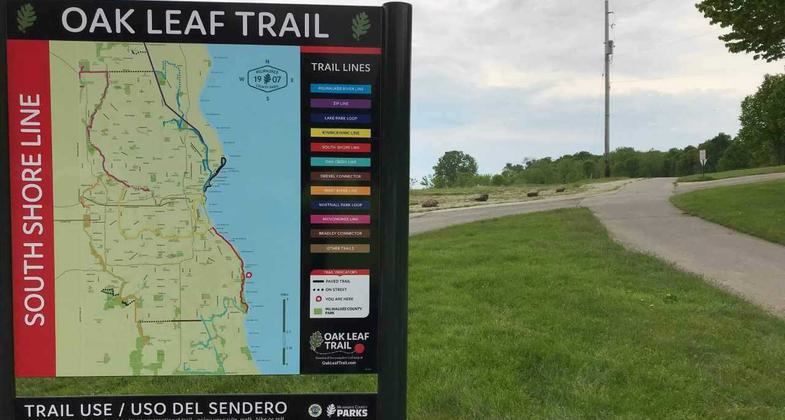
The South Shore Line of the Oak Leaf Trail tracks the shoreline of Lake Michigan from Grant Park in the south, through Warnimont Park, Sheridan Park, Bay View Park, South Shore Park, and Cupertino Park. The majority of this section is on off-road trails.
Location: At Warnimont Park in S. Milwaukee along Lake Michigan shorefront.
- States: Wisconsin
- Counties: Milwaukee
The South Shore Line of the Oak Leaf Trail tracks the shoreline of Lake Michigan from Grant Park in the south, through Warnimont Park, Sheridan Park, Bay View Park, South Shore Park, and Cupertino Park. The majority of this section is on off-road trails.
Accessibility Information
No text provided.
Allowed Uses:
Bicycling Dogs, on leash Hiking/WalkingPublic Contact
Milwaukee Co Dept. of Parks9480 Watertown Plank Rd.
Wauwatosa, WI 53226
(414) 257-7275
county.milwaukee.gov/EN/Park
Contact the trail manager for current maps and visiting details.
More Details
- Elevation (low): --
- Elevation (high): --
- Elevation (cumulative): --
- Part of a Trail System? No
- Surface (primary): Paved
- Surfaces (additional): --
- Tread Width (average): 0"
- Tread Width (minimum): --
- Running length (minimum): --
- Tread Grade (average, percent): --
- Tread Grade (maximum):
- Running length (maximum): --
- Cross-slope (average, percent): --
- Cross-slope (maximum): --
- Running length (maximum): --
- Certified as an NRT
Mar 7, 1973


