Oak Mountain Red Trail
check with the trail manager for updated details before visiting.
Oak Mountain Red Trail
State
Backcountry Trail
- Length
25 miles
- Elevation Gain
--
- Route Type
Loop
- Length
25 miles - Elevation Gain
-- - Route Type
Loop
In the foothills of the Appalachians, the mountain bike trail system, dubbed the "Red Trail," is nearly 25 miles and is part of an array of activities this Alabama State Park has to offer.
Location: Oak Mountain State Park near Birmingham, AL
- States: Alabama
- Counties: Shelby
- Cities/Townships: Pelham
In the foothills of the Appalachians, Double Oak Mountain lies at the core of the nearly 10,000-acre Oak Mountain State Park, located just 20 minutes south of Birmingham in Pelham, Alabama. The slopes and valleys of the parallel ridgelines serve up miles of blissful single-track and technical diversity. The mountain bike trail system, dubbed the "Red Trail", is part of an array of activities this Alabama State Park has to offer. The Birmingham Urban Mountain Pedalers (BUMP) along with Alabama's DCNR State Park Division, Shelby County and the City of Pelham have worked hand in hand to elevate the caliber of mountain biking at this venue.
Consider an assortment of natural surface trails from exciting, family-oriented riding to boulder outcrops that favor the most advanced riders; all flowing seamlessly with the surrounding vistas, lakes, and natural features. The makeup of this trail system has evolved into a stacked loop that offers several different mileage options out of the South Trailhead parking lot. For an all-day epic ride, consider the following route:
Start out from the South Trailhead and onto the Lake Trail for some stunning views of Double Oak Lake before pedaling your way around and over the folds of the northern valley. You might be tempted to try out a few purpose-built features or to take a detour on our Pump Track. If that's not enough, you'll also catch a glimpse at some of the park's Civilian Conservation Corps (CCC) structures built during the Depression era.
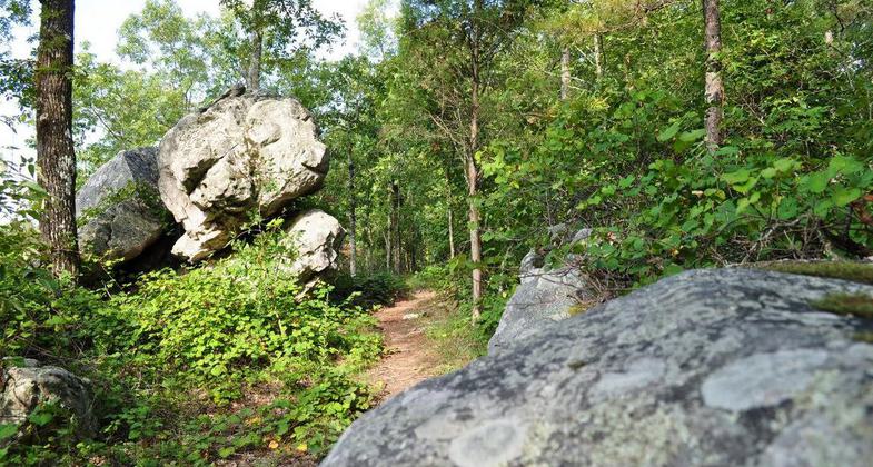
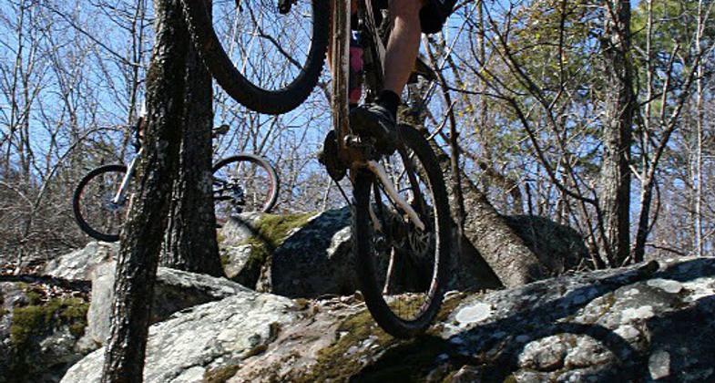
Next, you're in store for a 600-foot climb up to the ridge, where a couple of options await you. Try your hand at the expert-level Boulder Ridge section where you'll find a littering of boulder fields and drops certain to test every inch of travel on your ride or continue on a fast and rocky fire road towards West Ridge. Offering stunning views of the accompanying ridgeline and northern Shelby County, West Ridge is a section you won't want to miss. The native vegetation and rock formations in the area are something to behold but don't take your eyes off the trail for too long because this advanced section is sure to challenge your handling skills.
Lastly, it's time to head down Double Oak Mountain through the legendary Blood Rock section and onwards to a screaming Johnson's Mountain descent. The ebb and flow of Rattlesnake Ridge wrap things up as you make your way back to the South Trailhead, where you're sure to find plenty of Southern hospitality among the locals celebrating their favorite post-ride traditions. Get your ride and yourself cleaned up at the bike wash and changing room before taking your pick among the many food establishments just outside the park's gate.
Accessibility Information
No text provided.
Allowed Uses:
Bicycling Dogs, on leash Hiking/WalkingPublic Contact
Michael JeffreysAlabama DCNR/State Parks Division
200 Terrace Drive
Pelham, AL 35124
[email protected] • (205) 620-2520
Contact the trail manager for current maps and visiting details.
More Details
- Elevation (low): 550
- Elevation (high): 1290
- Elevation (cumulative): --
- Part of a Trail System? No
- National Designations: IMBA Epic Trail
- Surface (primary): Soil
- Surfaces (additional): --
- Tread Width (average): 24"
- Tread Width (minimum): 12
- Running length (minimum): --
- Tread Grade (average, percent): --
- Tread Grade (maximum):
- Running length (maximum): --
- Cross-slope (average, percent): 0
- Cross-slope (maximum): --
- Running length (maximum): --
- Certified as an NRT
May 29, 2012


