Obey River Canoe Trail
check with the trail manager for updated details before visiting.
Obey River Canoe Trail
U.S. Corps of Engineers
Water Trail (other)
- Length
8 miles
- Elevation Gain
--
- Route Type
out & back
(1 review)
- Length
8 miles - Elevation Gain
-- - Route Type
out & back
The Obey River is a 47.8-mile-long tributary of the Cumberland River in Tennessee. It joins the Cumberland River on the western edge of the town of Celina. Through the Cumberland and Ohio Rivers, the Obey River is part of the Mississippi River watershed.
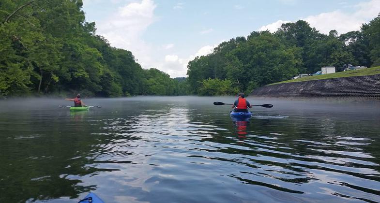
Beautiful day on the Obey River. Photo by Shannon Ours.

Photo by Shannon Ours.

Photo by Shannon Ours.

Photo by Shannon Ours.

Location: In Celina on SR 53, below Dale Hollow Dam.
- States: Tennessee
The Obey River is a 47.8-mile-long tributary of the Cumberland River in Tennessee. It joins the Cumberland River on the western edge of the town of Celina. Through the Cumberland and Ohio Rivers, the Obey River is part of the Mississippi River watershed. The Obey was impounded by the U.S. Army Corps of Engineers to form Dale Hollow Reservoir, the site of the Dale Hollow National Fish Hatchery, which stocks the Obey River and many other rivers and lakes around the Southeast with rainbow trout. The Obey serves as a camping, fishing, kayaking, and canoeing destination for local residents and visitors.
Accessibility Information
No text provided.
Reviews
Shannon Ours
One our favorites!
The Obey River is one of our favorite Tennessee rivers to kayak! It's clear and cool even on the hottest days!
Allowed Uses:
Boating, human-poweredPublic Contact
US Army Corps of EngineersRoute 1
Celina, TN 38551
More Details
- Elevation (low): --
- Elevation (high): --
- Elevation (cumulative): --
- Part of a Trail System? No
- Surface (primary): --
- Surfaces (additional): --
- Tread Width (average): 0"
- Tread Width (minimum): --
- Running length (minimum): --
- Tread Grade (average, percent): --
- Tread Grade (maximum):
- Running length (maximum): --
- Cross-slope (average, percent): --
- Cross-slope (maximum): --
- Running length (maximum): --
- Certified as an NRT
Aug 16, 1982