Ohio River Water Trail, Parkersburg WV
check with the trail manager for updated details before visiting.

Ohio River Water Trail, Parkersburg WV
City, Town, or County
National Water Trail
- Length
57 miles
- Elevation Gain
--
- Route Type
out & back
- Length
57 miles - Elevation Gain
-- - Route Type
out & back
57.7 miles. The 3.49 miles of the Ohio River and the 18.1 miles of the Little Kanawha River within Wood County, WV. 13 Access points

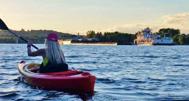
Ohio River Water Trail. Photo by Duane Jones

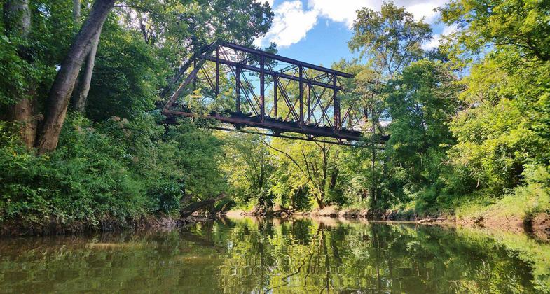
Pratt Truss Bridge, Duck Creek (Ohio River Water Trail) Photo: Duane Jones

Ohio River Water Trail, Blennerhassett Island Photo: Kim Coram

Parkersburg Point Park. Photo: John Wiseman

WCATC volunteers at the River,Trails and Ales Festival (Marietta, OH). Talking to people about the Water Trail.

WCATC volunteers at Marietta Earth Day, talking to people about biking, hiking and paddling opportunities in Wood County.

WCATC volunteers at Grand Central Mall Safety Day, talking to people about healthy lifestyles, including the Water Trail and local bike trails.

Water Trail brochure, page 2, features access locations and safety information.

Water Trail map, available online and in hotel lobbies etc.

The Facebook page includes photos of what to expect on the suggested paddle trips, in this case a long culvert on Neal Run. Photo: Trampus Hill.
Location: The Ohio River and Little Kanawha River within Wood County, WV
- States: Ohio, West Virginia
- Counties: Wood, Washington
- Cities/Townships: Marietta OH, Williamstown WV, Parkersburg WV, and Belpre, OH.
The Ohio River Water Trail is exceptionally accessible to residents and visitors. The Water Trail borders the cities of Marietta OH, Williamstown WV, Vienna WV, Parkersburg WV, and Belpre OH. It is crossed by Interstate 77 and US Route 50.
There are multiple public trailer-ready boat ramps with ample parking along the Water Trail. Half the Trail access sites have ADA-compliant parking, ADA-compliant restrooms, and ADA-compliant access to the water. Although roads and railroads follow the river, they are generally not visible from the river below. Trees along the river bank often block out views of homes, farm fields, and industrial sites. Paddlers along the Ohio River can feel a sense of remoteness and natural beauty.
The island chutes (the narrower, not commercially navigable, sections between an island and the shore) also offer remote natural settings. The many backwaters, and tributary creeks flooded by the elevated water levels caused by the Belleville Lock and Dam, offer different experiences, that of a narrow creek or perhaps a quiet pond or wetland, away from the commercial and recreational traffic of the river.
The Ohio River offers abundant wildlife to enjoy, the Water Trail is between two major bird migration routes, which results in high species diversity along the river. Nearly 200 species of birds visit the Ohio River each year, including osprey and bald eagles. There are over 100 species of fish in the Ohio River, including spotted bass, sauger, freshwater drum, channel, and flathead catfish. Both West Virginia and residential Ohio fishing licenses are honored on the Ohio River. There are over 25 mammal species along the Ohio River and Little Kanawha River, including white-tailed deer, raccoons, muskrats, mink, cottontail rabbits, and red foxes. Frogs, toads, turtles, dragonflies, damselflies, butterflies, and forty species of freshwater mussels add to the astonishing bio-diversity of these rivers.
Three of the islands on the Trail are part of the Ohio River Islands National Wildlife Refuge. Visitors are welcome to pull their canoes and kayaks up onto the shore and explore these islands on foot during the day.
The rich engineering history of the Oho River can be best viewed and appreciated from the Water Trail, including:
- Blennerhassett Island Bridge. Built-in 2008, a Network Tied Arches bridge, the second of this type built in the US.
- CSX Ohio River Bridge. Through truss bridge, originally built in 1870. The longest bridge in the world upon completion at 1.4 miles.
- Harmar Bridge. A Pratt through truss bridge with manual swing draw span over Muskingum River.
- Williamstown Bridge, a through truss bridge, was built in 1992.
- I-77 Bridge. Through truss bridge, built in 1965.
- CSX Little Kanawha River Bridge. A Polygonal Warren through truss design
- 5th Street Bridge. Rivet connected Polygonal Warren through a truss, built in 1935, and refurbished in 1998. This bridge is historically significant for its association with the Works Progress Administration and features special plaques that appear on some Depression-era bridges across the country.
- Parkersburg Flood Wall, completed in 1956.
Canoes, river transportation, and river transportation technology are integral to the history of the Mid-Ohio Valley, and trail users have an opportunity to share the experiences of the natives, the pioneers, the settlers, and even the fugitive slaves who paddled these waters in the past.
Accessibility Information
No text provided.
Allowed Uses:
Boating, motorized Boating, human-powered SwimmingOther Activities
- Camping
- Fishing
- Heritage and history
- Hunting
- Wildlife viewing / observation
Public Contact
Mark LewisGreater Parkersburg CVB
350 7th Street
Parkersburg, WV 26101
[email protected] • (304) 428-1130
More Details
- Elevation (low): --
- Elevation (high): --
- Elevation (cumulative): --
- Part of a Trail System? No
- National Designations: Lewis and Clark NHT
- State Designations: West Virginia Water Trail
- Surface (primary): --
- Surfaces (additional): Rock, boulders, Rock, smooth
- Tread Width (average): 0"
- Tread Width (minimum): 0
- Running length (minimum): --
- Tread Grade (average, percent): --
- Tread Grade (maximum):
- Running length (maximum): --
- Cross-slope (average, percent): 0
- Cross-slope (maximum): --
- Running length (maximum): --
- Certified as an NRT
Oct 25, 2020

