Old Baldy Super Loop
check with the trail manager for updated details before visiting.
Old Baldy Super Loop
USDA Forest Service
- Length
12.9 miles
- Elevation Gain
--
- Route Type
out & back
- Length
12.9 miles - Elevation Gain
-- - Route Type
out & back
Old Baldy is the shortest and steepest, while the Super Trail is longer but has a more moderate gradient, but both of these trails lead to the 9,543-foot summit of Mt. Wrightson, the highest peak in the Santa Ritas.
Location: In Coronado National Forest near Madera Canyon.
- States: Arizona
The trails form a figure eight making it possible to put together a number of different loops using different portions of each. Old Baldy is the most heavily traveled and also remains the coolest of the two by keeping a more northerly aspect and staying in the trees for almost its entire length. The Super Trail stays within the same drainage as its steeper cousin on the lower loop of the "8", but it follows a more south-facing slope through a high desert environment.
Above the midpoint of the "8" at Josephine Saddle, the Super Trail loops around the south side of the mountain through even more arid country, while Old Baldy switchbacks through thickets of New Mexico locust on a west-facing slope to Baldy Saddle. The last mile to the summit of Mt. Wrightson via the Crest Trail #144 is the same no matter which trails you've followed to the saddle.
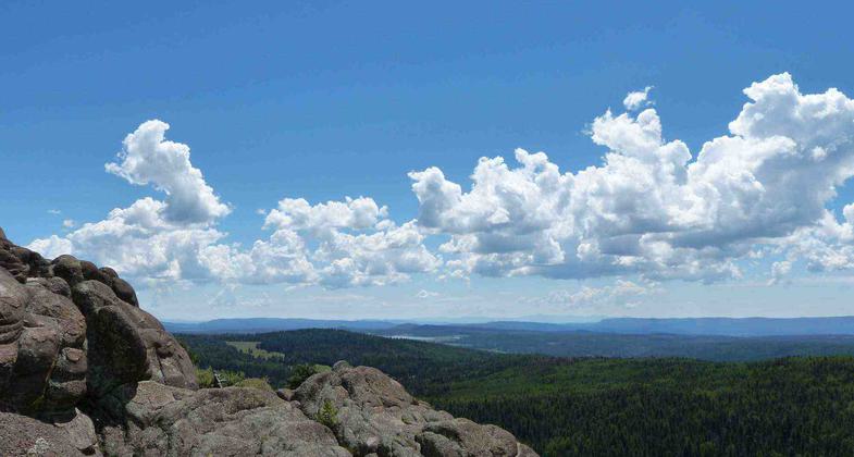
The views from the summit are, to say the least, breathtaking. The Santa Catalinas near Tucson, Mt. Graham to the east, and the high peaks of the Huachucas to the southeast combine with sweeping views of the Santa Cruz and San Pedro valleys to form a 360° panorama. Actually, you don't even have to go all the way to the top to enjoy great views. Many of these landmarks are visible from dozens of overlooks along both trails.
And while you're at it, remember that all that's worth seeing here is not in the distance. The birdwatcher's heaven that exists in Madera Canyon extends up the mountain into this area where, in addition to the birds, you have a chance to see Coues white-tailed deer, black bears, and even mountain lions. The trails also boast an impressive potpourri of tree species characteristic of southeastern Arizona including Arizona, Apache, and Chihuahua pines, as well as Arizona madrone and a variety of oaks.
Accessibility Information
No text provided.
Allowed Uses:
Hiking/WalkingPublic Contact
Coronado National Forest300 West Congress St.
Tuscon, AZ 85701
Contact the trail manager for current maps and visiting details.
More Details
- Elevation (low): --
- Elevation (high): --
- Elevation (cumulative): --
- Part of a Trail System? No
- Surface (primary): --
- Surfaces (additional): --
- Tread Width (average): 0"
- Tread Width (minimum): --
- Running length (minimum): --
- Tread Grade (average, percent): --
- Tread Grade (maximum):
- Running length (maximum): --
- Cross-slope (average, percent): --
- Cross-slope (maximum): --
- Running length (maximum): --
- Certified as an NRT
Dec 17, 1978


