Old Growth Ridge
check with the trail manager for updated details before visiting.
Old Growth Ridge
Bureau of Land Management
Backcountry Trail
- Length
1.5 miles
- Elevation Gain
--
- Route Type
out & back
- Length
1.5 miles - Elevation Gain
-- - Route Type
out & back

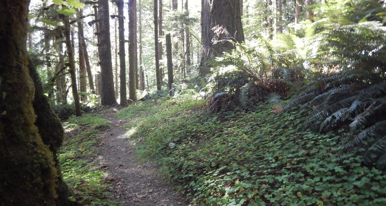
View of Old Growth Ridge Trail. Photo by Bureau of Land Management.

Winding Old Growth Ridge NRT
Location: From Eugene W on SR 126 50 mi. to Siuslaw River Access Rd. Turn S 2 mi. to Whittaker Creek Campground.
- States: Oregon
- Counties: Lane
Built in 1991 by Eugene BLM employees and volunteers, this unique footpath arises from the streamside in the moisture-rich hills called the Coast Range by local Willamette Valley residents. This is specifically a hiking trail, connected to a popular BLM campground, also called Whittaker Creek, and the trailhead can be accessed on the backside of the park at campsite 24. Vehicle parking is available in the campground parking lot, free of charge.
The trail climbs at a moderate rate, winding uphill through three significant ecosystems; riparian, second-growth Douglas fir, and the pristine Old Growth Ridge. Each system has its own special plant and animal species that thrive there.
The riparian or stream zone, is considered one of the premier salmon and steelhead streams in all of the Coast Range. The huge Chinook use it in November, followed by the smaller, more energetic Coho, or Silver salmon, in December, and finally the powerful Steelhead, from January thru early March. This year-round, cool water stream is also home to many four-legged critters that frequent its waters. It is also the nucleus of a semi-primitive campground that has become extremely popular with the greater Eugene-Springfield clientele. The site has 31 camp spaces with no electric hook-ups, a fine swimming area, and access to the Siuslaw River, which is only a short distance away. Some of the campsites are physically connected to the river itself.
The second growth zone is home to 60-year-old Douglas Fir stands, mixed with other tree species that make up a diverse ecosystem that is rapidly reaching maturity. The trail ascends to a ridge where in the 1950s logging activity ceased, and the higher reaches of the hill were left untouched. At that point, the hiker can witness old Douglas Fir trees in their original habitat. This area is also home to the Northern spotted owl and the marbled murrelet. The BLM rangers have built comfortable benches along the way for the hikers to rest and refresh themselves.
Presently, a mile-long loop is being added to the main trail and will be completed by September 2004 for the public to enjoy. The loop will highlight the scenic Whittaker Creek itself, traveling along its bank as it returns to the park area. This new, long-awaited enterprise will give the entire system a profound sense of completion. It will send new information regarding this leg when it's done.
Accessibility Information
No text provided.
Allowed Uses:
Boating, human-powered Swimming Hiking/WalkingOther Activities
- Camping
- Wildlife viewing / observation
Public Contact
Bureau of Land ManagementSpringfield Inter-agency
Springfield, OR 97477
[email protected]
(541)+683-6600
Contact the trail manager for current maps and visiting details.
More Details
- Elevation (low): 300
- Elevation (high): 1200
- Elevation (cumulative): --
- Part of a Trail System? No
- Surface (primary): Soil
- Surfaces (additional): Soil
- Tread Width (average): 30"
- Tread Width (minimum): --
- Running length (minimum): --
- Tread Grade (average, percent): 10
- Tread Grade (maximum): 16
- Running length (maximum): --
- Cross-slope (average, percent): --
- Cross-slope (maximum): --
- Running length (maximum): --
- Certified as an NRT
Jul 4, 1994

