Old Oak Trail
check with the trail manager for updated details before visiting.
Old Oak Trail
State
Backcountry Trail
- Length
3 miles
- Elevation Gain
--
- Route Type
out & back
(2 reviews)
- Length
3 miles - Elevation Gain
-- - Route Type
out & back

Photo by NDPRD/Flickr.

Beaver Lodge along Old Oak Trail

Welcome to Old Oak - Half-way Point Trail Old Oak Trail
Location: At Lake Metigoshi SP, 13 mi. N of Bottineau.
- States: North Dakota
- Counties: Bottineau
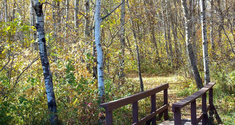
Certified in 1976 as a National Recreation Trail the Old Oak became North Dakota's first nationally recognized trail and is located at Lake Metigoshe State Park. The 3-mile nature trail winds through the aspen, birch, and oak forests of the Turtle Mountains along the Canada-US border. Interpretive markers are placed along the trail with a corresponding brochure to identify natural wonders. The trail can be used for hiking, biking, snowshoeing, and cross-country skiing.
NOTE: an NRT Trail Ambassador walked this trail on 5/28/2018 and reports that the second half of the loop has several trees across the trail.
Accessibility Information
No text provided.
Reviews
Wendy Schmeichel
The first part of trail was well maintained. Once reached halfway point it wasn't as well maintained. Had to step over a couple downed trees and it was hard to follow trail.
Amber Cozad
Great Interpretive Hike!
The trail was well maintained and I had a great experience doing the guided interpretive hike offered by the park staff.
Allowed Uses:
Bicycling Swimming Dogs, on leash Hiking/Walking Snow, cross-country skiing Snow, snowshoeingOther Activities
- Camping
- Snow, snow play general
- Wildlife viewing / observation
Public Contact
Larry HagenNorth Dakota Parks & Recreation
#2, Lake Metigoshe State Park
Bottineau, ND 58318
[email protected] • (701) 263-4651
Contact the trail manager for current maps and visiting details.
More Details
- Elevation (low): 1516
- Elevation (high): 2184
- Elevation (cumulative): --
- Part of a Trail System? No
- Surface (primary): --
- Surfaces (additional): --
- Tread Width (average): 60"
- Tread Width (minimum): --
- Running length (minimum): --
- Tread Grade (average, percent): --
- Tread Grade (maximum):
- Running length (maximum): --
- Cross-slope (average, percent): --
- Cross-slope (maximum): --
- Running length (maximum): --
- Certified as an NRT
Apr 5, 1976


