Old Post Road Mountain Bike Trail
check with the trail manager for updated details before visiting.
Old Post Road Mountain Bike Trail
U.S. Corps of Engineers
Backcountry Trail
- Length
8.71 miles
- Elevation Gain
--
- Route Type
Loop
- Length
8.71 miles - Elevation Gain
-- - Route Type
Loop
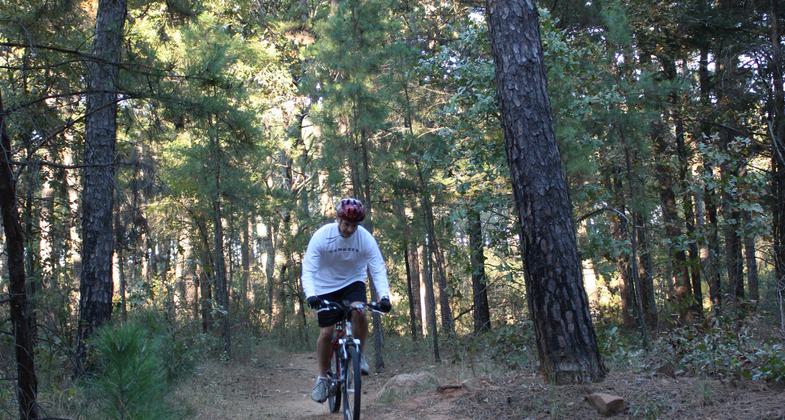
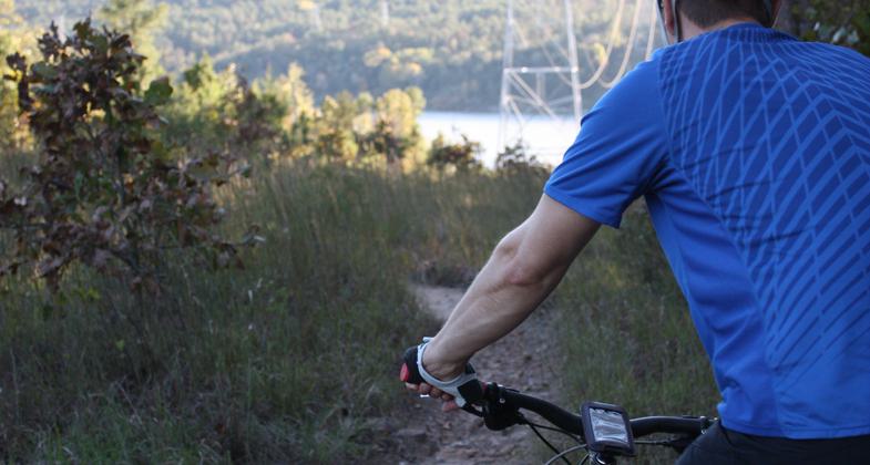
Old Post Road Mountain Bike Trail hosts a series of twelve interconnecting loops offering the mountain bike enthusiast over 8 miles of trail in one great place. It is open free to the public year round.
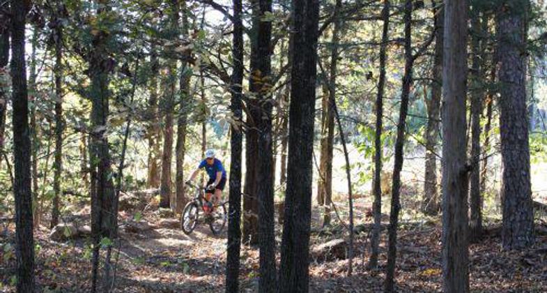
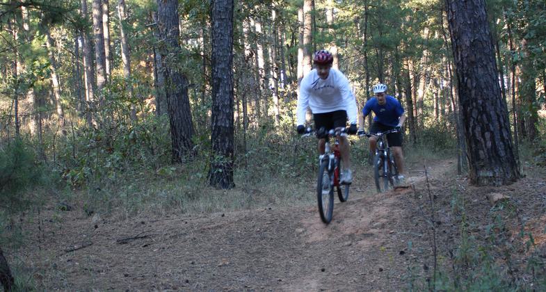
Mountain Biking.

Photo by US Army Corp of Engineers.

Photo by US Army Corp of Engineers.

Photo by US Army Corp of Engineers.
Location: Near Russellville, Arkansas, in Old Post Road Park
- States: Arkansas
- Counties: Pope
The Old Post Road Mountain Bike Trail system consists of twelve interconnecting loops of over 8 miles of trail in one great place, Old Post Road Park. This trail is free to the public and open year-round. The various loops can be accessed from two different trailheads both located within the park. Amenities within the park include flush toilets, kiosks with trail maps, paved parking, basketball, volleyball, and tennis courts, a large playground, eight pavilions, a soccer field, and a 40-site campground hosting showers, a dump station and electric and water hookups at each site. The Arkansas River Visitor Center is located between Old Post Road Mountain Bike Trailheads, offering history on the US Army Corps of Engineers and the multitude of outdoor activities within the Arkansas River Valley.
Loops within Old Post Mountain Bike Trail vary in difficulty. Easy Rider Trail is a great trail for beginning mountain bikers and also a perfect place to warm up or cool down from a great ride. All other trails interconnect and vary from modest to intermediate skill level allowing everyone the opportunity for a personalized ride. It is recommended that less experienced riders walk their bikes through technical stretches. Remember that safety comes first with the US Army Corps of Engineers: please wear your safety gear. The trail crosses the roadway within the park at both trailheads. Please be careful at all road crossings.
Visit the Arkansas River Visitor Center and peruse the many outdoor opportunities that the Arkansas River Valley has to offer. The Visitor Center Attendant will assist you with questions and direct you to the multitude of free literature on activities within the area. Lake Dardanelle offers many federal, state, and city parks that will meet the needs of any visitor. The park lies just outside Russellville's city limit, which offers a host of hotels, restaurants, and shopping.
Rules of the trail:
1. Control your bicycle. This is particularly important when you meet others on the trail. Good balance and proper braking are essential mountain biking skills.
2. Leave no trace. Don't ride in conditions where you will leave evidence of your passing, especially on certain soils after rain. Stay on existing trails and don't create new ones. Leave what you find and pack out your trash.
3. Always yield the trail. The steps are simple; slow down, establish communication with the people you meet, and pass safely. Yielding doesn't always mean stopping and dismounting, though sometimes that's the best idea.
4. Never spook animals. It doesn't matter if it's a fox, bear, or deer. Give all animals plenty of room and try not to startle them.
5. Plan ahead. Carry everything you need for a good ride: a spare tube and a pump, a rain jacket, and basic tools. Know where you're riding. Wear a helmet.
6. Pick up a map.
Accessibility Information
No text provided.
Allowed Uses:
Bicycling Hiking/WalkingOther Activities
- Wildlife viewing / observation
Public Contact
Scott FryerUS Army Corps of Engineers
1598 Lock and Dam Road
Russellville, AR 72802
[email protected] • (479) 968-5008
Contact the trail manager for current maps and visiting details.
More Details
- Elevation (low): 336
- Elevation (high): 540
- Elevation (cumulative): --
- Part of a Trail System? No
- Surface (primary): Soil
- Surfaces (additional): Boardwalk, Grass or Vegetation, Rock, boulders, Rock, smooth, Soil, Soil with stabilizer
- Tread Width (average): 24"
- Tread Width (minimum): --
- Running length (minimum): --
- Tread Grade (average, percent): --
- Tread Grade (maximum):
- Running length (maximum): --
- Cross-slope (average, percent): --
- Cross-slope (maximum): --
- Running length (maximum): --
- Certified as an NRT
May 19, 2011