Oregon High Desert Trail
This information is a public record of the 1992 NRT application and may be out of date if it has not been updated by a trail manager --
check with the trail manager for updated details before visiting.
check with the trail manager for updated details before visiting.
Oregon High Desert Trail
Bureau of Land Management
Backcountry Trail
- Length
150 miles
- Elevation Gain
--
- Route Type
out & back
- Length
150 miles - Elevation Gain
-- - Route Type
out & back

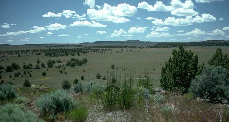
Oregon High Desert near Frenchglen. Photo by BLM/wiki.

Oregon Badlands area. A mixture of sage, pine, tumulus, and ash-like soil. Photo by EncMstr/wiki.
Location: In the Steens Mountains, Southeastern Oregon
- States: Oregon
- Counties: Harney
The Desert Trail Association http://www.thedeserttrail.org/ was working to create a National Scenic Desert Trail from Mexico to Canada since the 1980s and part of that route is nationally designated (see above link). The route created by the Oregon Natural Desert Association www.onda.org/oregondeserttrail is the 750-mile Oregon Desert Trail and ties into a few sections of their route in the Pueblos & Steens Mountain, but we are a separate entity and organization.
Accessibility Information
No text provided.
Allowed Uses:
Hiking/WalkingPublic Contact
Bureau of Land ManagementHC 74-12533 Hwy. 20 West
Hines, OR 97738
Contact the trail manager for current maps and visiting details.
More Details
- Elevation (low): --
- Elevation (high): --
- Elevation (cumulative): --
- Part of a Trail System? No
- Surface (primary): --
- Surfaces (additional): --
- Tread Width (average): 0"
- Tread Width (minimum): --
- Running length (minimum): --
- Tread Grade (average, percent): --
- Tread Grade (maximum):
- Running length (maximum): --
- Cross-slope (average, percent): --
- Cross-slope (maximum): --
- Running length (maximum): --
- Certified as an NRT
Sep 19, 1992

