Ottawa Wildlife Interpretive Trail
This information is a public record of the 1981 NRT application and may be out of date if it has not been updated by a trail manager --
check with the trail manager for updated details before visiting.
check with the trail manager for updated details before visiting.
Ottawa Wildlife Interpretive Trail
U.S. Fish and Wildlife Service
- Length
9 miles
- Elevation Gain
--
- Route Type
out & back
- Length
9 miles - Elevation Gain
-- - Route Type
out & back

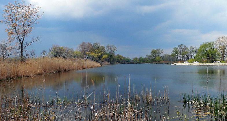
Ottawa National Wildlife Refuge, Ohio, USA. Photo by Dakota Callaway/wiki.

Ottawa National Wildlife Refuge, Oak Harbor, Ohio. Photo by Niagara66/wiki.
Location: Located 15 miles east of Toledo, or 15 miles west of Port Clinton, Ohio, on state route 2. At Ottawa NWR on Lake Erie N of SR 2, 15 mi. E of Toledo.
- States: Ohio
The Ottawa National Wildlife Refuge is a 5,300-acre refuge for migratory waterfowl, shorebirds, songbirds, and many other wildlife species. The 9 miles of trail travel around diked wetlands, through wood lots, and past grasslands. Loops permit a short or long hike and a variety of habitats allow for a variety of viewing opportunities.
Accessibility Information
No text provided.
Allowed Uses:
Hiking/WalkingPublic Contact
Ottawa National Wildlife Refuge14000 W State Rt. 2
Oak Harbor, OH 43449
(419) 898-0014
www.fws.gov/midwest/ottawa
Contact the trail manager for current maps and visiting details.
More Details
- Elevation (low): --
- Elevation (high): --
- Elevation (cumulative): --
- Part of a Trail System? No
- Surface (primary): Rock, crushed
- Surfaces (additional): Rock, crushed
- Tread Width (average): 120"
- Tread Width (minimum): --
- Running length (minimum): --
- Tread Grade (average, percent): --
- Tread Grade (maximum):
- Running length (maximum): --
- Cross-slope (average, percent): --
- Cross-slope (maximum): --
- Running length (maximum): --
- Certified as an NRT
Mar 19, 1981

