Ouachita Geo-Float Trail
check with the trail manager for updated details before visiting.
Ouachita Geo-Float Trail
U.S. Corps of Engineers
Water Trail (other)
- Length
16 miles
- Elevation Gain
--
- Route Type
out & back
- Length
16 miles - Elevation Gain
-- - Route Type
out & back
The Lake Ouachita Geo Float Trail is a 16 mile water-based trail from Spillway Recreation Area to Brady Mountain Recreation Area. This unique trail highlights natural geological features.
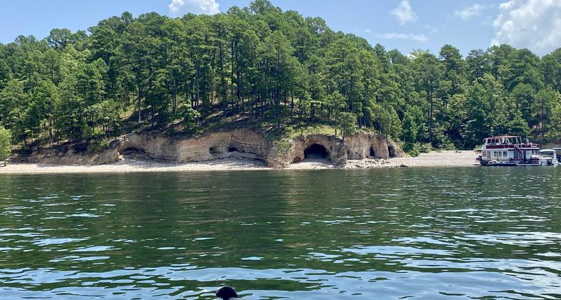
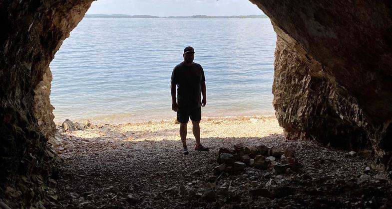
Lake Ouachita Caves. Photo by Neeley Vance.

Lake Ouachita Cave. Photo by Neeley Vance.

Recumbent Fold.

Checkerboard Point.
Location: Rural, At Lake Ouachita NW of Hot Springs GPS coordinates for first"stop" on Geo Float Trail are: 34.58945N/093.22230W
- States: Arkansas
- Counties: Garland
The first of its kind, this float trip was a project of the US Army Corps of Engineers, the Arkansas Geologic Commission, and the US Geological Survey. Lake Ouachita is located 13 miles northwest of Hot Springs, in the heart of the Ouachita Mountains. The lake and adjacent land areas are managed by the Corps.
The guidebook begins with this introduction: Welcome to a region where, 250 to 300 million years ago, the earth's surface was bent, twisted, and deformed in ways that still baffle professional geologists. The self-guided Ouachita Geo-Float Trail takes you, in your own boat, across the water of Lake Ouachita to some of the most unique geologic features in the world.
As the seasons change, so do the natural features of Lake Ouachita. During the fall and winter months it is easier to view the geologic features because the water level is low, but remember, low water levels can make boating hazardous because rocks, stumps, and other obstructions are closer to the surface and the bottom of your boat! Also watch the weather, the time of day, and the gas gauge. Safe boating will make your day more enjoyable.
The Ouachita Geo-Float trail includes many unique geologic features on the lake, but by no means points out all the interesting natural features you will see. The trail is a 16-mile (25.7 km) trip from the Spillway Recreation Area to Brady Mountain Recreation Area and will take about 1-1/2 hours to complete. The time will vary depending on your boat's speed and the time you spend at each stop. Follow the map to the bright yellow buoys which mark specific stops along the route. For a better understanding of the features, we suggest that you begin at Stop A and continue in alphabetical order.
Accessibility Information
No text provided.
Allowed Uses:
Boating, motorized Boating, human-powered SwimmingOther Activities
- Fishing
- Wildlife viewing / observation
Public Contact
Amy ShultzUS Army Corps of Engineers
1424 Blakely Dam Road
Royal, AR 71968
[email protected] • (501) 767-2108
More Details
- Elevation (low): 578
- Elevation (high): 578
- Elevation (cumulative): --
- Part of a Trail System? No
- Surface (primary): Water, calm
- Surfaces (additional): Water, calm
- Tread Width (average): 0"
- Tread Width (minimum): --
- Running length (minimum): --
- Tread Grade (average, percent): --
- Tread Grade (maximum):
- Running length (maximum): --
- Cross-slope (average, percent): --
- Cross-slope (maximum): --
- Running length (maximum): --
- Certified as an NRT
Sep 3, 1980