Pacific Northwest Trail - Olympic National Park Segment
check with the trail manager for updated details before visiting.
Pacific Northwest Trail - Olympic National Park Segment
National Park Service
Backcountry Trail
- Length
102.7 miles
- Elevation Gain
--
- Route Type
out & back
- Length
102.7 miles - Elevation Gain
-- - Route Type
out & back

Mt. Olympus from the PNT. Photo Courtesy of https://www.pnt.org/. Photo by Jeff Kish.

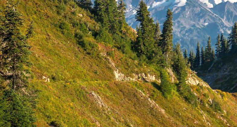
Pacific Northwest Trail in Olympic National Park, View from the east side of Hayden Pass down the Dosewallips valley.

Pacific Northwest Trail in Olympic National Park, View from the east side of Hayden Pass down the Dosewallips valley.

Exploring the shores and tide pools on the Straight of Juan de Fuca. Photo by Indra Davis.

Section Hiking the Pacific Coast shoreline near the western terminus. Photo by Indra Davis.
Location: ONP boundary between Boulder Shelter and Home Lake via Trailhead on USFS 2870 and trails 840, 833.3 and 893 through Buckhorn Wilderness to ONP boundary on the Bogachiel River Trail via USFS trail 825 and trailhead on USFS 2932.
- States: Washington
- Counties: Clallam, Jefferson
On the Olympic Peninsula, the Pacific Northwest Trail crosses the largest wilderness in Washington and the rugged Olympic Mountains. Although the Olympics are lower in elevation than the Cascades, they should not be underestimated. This diverse landscape is as formidable as hikers will find anywhere on the PNT, and weather conditions can change quickly.
In the National Park, visitors share berry-filled meadows with black bears beneath glacier-clad Mt. Olympus and follow roaring rivers through ancient forests dripping with moss. The Park serves as a refuge of biodiversity, with many endemic plants and animals, like the Olympic marmot, exclusive to this unique mountain environment.
On the western end, the PNT explores the less-traveled trails along the Bogachiel River, where jungle-like, temperate rain forests, fueled by 12 feet of annual rainfall, are home to massive Sitka spruce, mountain hemlock, and herds of Roosevelt Elk.
Accessibility Information
No text provided.
Allowed Uses:
Hiking/WalkingPublic Contact
Pacific Northwest Trail Association24854 CJ Memorial Circle #4
Sedro Wooley, WA 98284
[email protected] • (360) 854-9415
www.pnt.org
Contact the trail manager for current maps and visiting details.
More Details
- Elevation (low): 380
- Elevation (high): 6500
- Elevation (cumulative): --
- Part of a Trail System? No
- National Designations: Community Millenium
- Surface (primary): Soil
- Surfaces (additional): Soil
- Tread Width (average): 24"
- Tread Width (minimum): --
- Running length (minimum): --
- Tread Grade (average, percent): 10
- Tread Grade (maximum): 35
- Running length (maximum): --
- Cross-slope (average, percent): --
- Cross-slope (maximum): --
- Running length (maximum): --
- Certified as an NRT
Jun 2, 2003


