Paintsville Lake Kiwanis Trail
This information is a public record of the 1993 NRT application and may be out of date if it has not been updated by a trail manager --
check with the trail manager for updated details before visiting.
check with the trail manager for updated details before visiting.
Paintsville Lake Kiwanis Trail
State
Frontcountry Trail
- Length
1.54 miles
- Elevation Gain
--
- Route Type
out & back
- Length
1.54 miles - Elevation Gain
-- - Route Type
out & back
The trail is 1.6 miles long and rated easy.

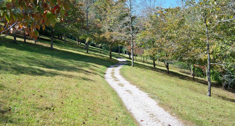
Part of the Paintsville Lake Kiwanis Trail in Staffordsville, Kentucky. Photo by Wikicommons.

View of Paintsville Lake and Rocky Knob Recreation Area from park ranger station. Photo by Wikicommons.
Location: Near Staffordsville at S end of Paintsville Lake.
- States: Kentucky
The trail begins along and above Paintsville Lake on gently sloped terrain surrounded by Eastern white pine, dogwood, and persimmon trees. The trail is 1.6 miles long and rated easy. Plenty of scenic views of the lake, located across from the administration building at the Mountain Home Place, wildlife viewing is also possible
Accessibility Information
No text provided.
Allowed Uses:
Hiking/WalkingPublic Contact
Robert BeverleyUS Army Corps of Engineers
Paintsville Lake
Staffordsville, KY 41256
[email protected] • (606) 297-6312
Contact the trail manager for current maps and visiting details.
More Details
- Elevation (low): --
- Elevation (high): --
- Elevation (cumulative): --
- Part of a Trail System? No
- Surface (primary): --
- Surfaces (additional): --
- Tread Width (average): 48"
- Tread Width (minimum): --
- Running length (minimum): --
- Tread Grade (average, percent): --
- Tread Grade (maximum):
- Running length (maximum): --
- Cross-slope (average, percent): --
- Cross-slope (maximum): --
- Running length (maximum): --
- Certified as an NRT
May 26, 1993

