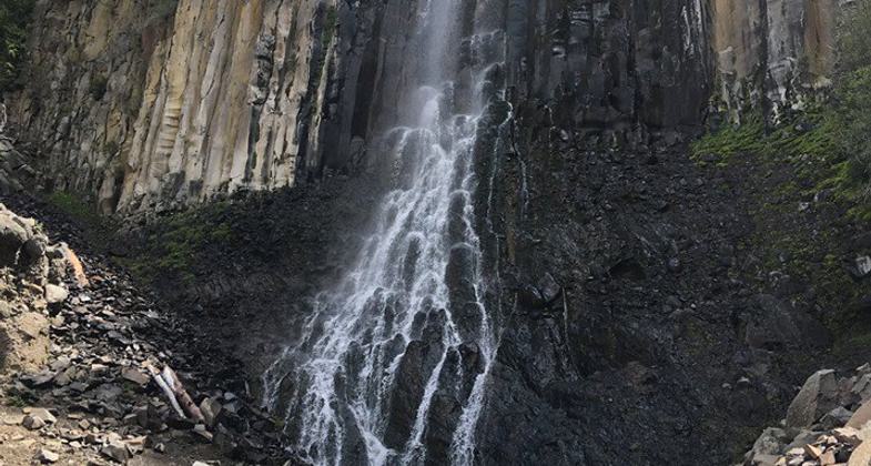
Palisade Falls
This information is a public record of the 1977 NRT application and may be out of date if it has not been updated by a trail manager --
check with the trail manager for updated details before visiting.
check with the trail manager for updated details before visiting.
Palisade Falls
USDA Forest Service
Backcountry Trail
- Length
0.6 miles - Elevation Gain
-- - Route Type
out & back
Hyalite Canyon, 15 mi. SE of Bozeman
Location: 15 miles southeast of Bozeman, MT.
- States: Montana
- Counties: Gallatin
Popular .5 mile nature trail, fully accessible and paved, providing views to Palisade Falls. Picnic area and accessible vault toilet at trailhead.
Accessibility Information
No text provided.
Allowed Uses:
Hiking/WalkingPublic Contact
Brian McNeilUS Forest Service
3710 Fallon St., Suite C
Bozeman, MT 59718
bmcneil@fs.fed.us • (406) 522-2520
www.fs.fed.us/r1/gallatin
Contact the trail manager for current maps and visiting details.
More Details
- Elevation (low): 5600
- Elevation (high): 5600
- Elevation (cumulative): --
- Part of a Trail System? No
- Surface (primary): Paved
- Surfaces (additional): Paved
- Tread Width (average): 60"
- Tread Width (minimum): --
- Running length (minimum): --
- Tread Grade (average, percent): 7
- Tread Grade (maximum): 18
- Running length (maximum): --
- Cross-slope (average, percent): --
- Cross-slope (maximum): --
- Running length (maximum): --
- Certified as an NRT
Nov 30, 1977


