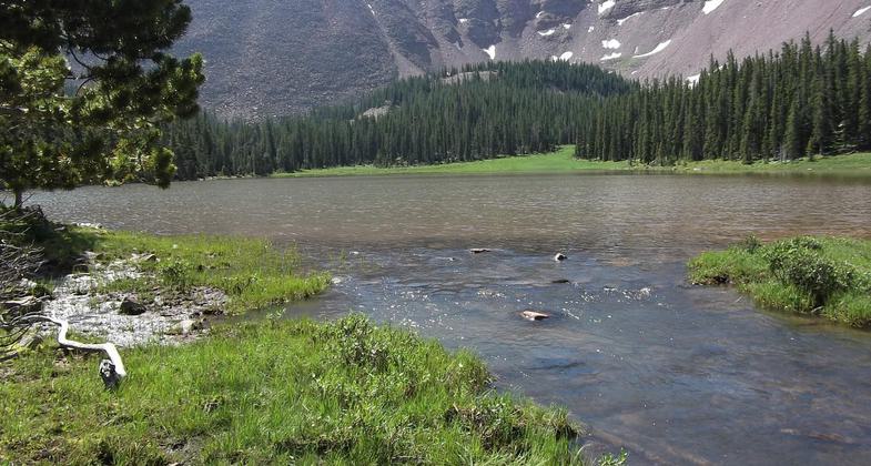
Palisade Mountain
check with the trail manager for updated details before visiting.
Palisade Mountain
USDA Forest Service
Backcountry Trail
- Length
6 miles
- Elevation Gain
--
- Route Type
out & back
- Length
6 miles - Elevation Gain
-- - Route Type
out & back
The Palisade trail is 4.9 miles long. It begins at Forest Road 1348 (Willow Mountain) and ends at Forest Trail 86 (Skalkaho-Gird).
Location: 18 miles east of Hamilton, MT. In the Bitterroot National Forest, 3 mi. S of Hamilton on US 93 take SR 38 E for 9 miles. Turn left on FR 714 for 20 miles to trailhead.
- States: Montana
- Counties: Ravalli
The Palisade trail is 4.9 miles long. It begins at Forest Road 1348 (Willow Mountain) and ends at Forest Trail 86 (Skalkaho-Gird).
This trail skirts the northern edge of the 20,000-acre Skalkaho Game Preserve and ends at Burnt Fork Lake in the Sapphire Mountains. Travel along the ridge trail offers views of the scenic Bitterroot Mountains and opportunities to see the big game. The trailhead, 18 miles northeast of Hamilton, MT on the Willow Creek Road, has a developed campsite, horse-feed bunks, and hitchrails.
Accessibility Information
No text provided.
Allowed Uses:
Equestrian Hiking/WalkingPublic Contact
Mike WilsonStevensville RD
88 Main St.
Stevensville, MT 59870
(406) 777-5461
Contact the trail manager for current maps and visiting details.
More Details
- Elevation (low): 7500
- Elevation (high): 8500
- Elevation (cumulative): --
- Part of a Trail System? No
- Surface (primary): Soil
- Surfaces (additional): Soil
- Tread Width (average): 24"
- Tread Width (minimum): --
- Running length (minimum): --
- Tread Grade (average, percent): 10
- Tread Grade (maximum): 25
- Running length (maximum): --
- Cross-slope (average, percent): --
- Cross-slope (maximum): --
- Running length (maximum): --
- Certified as an NRT
Aug 17, 1980


