Patriots' Path
check with the trail manager for updated details before visiting.
Patriots' Path
City, Town, or County
Frontcountry Trail
- Length
75 miles
- Elevation Gain
--
- Route Type
out & back
- Length
75 miles - Elevation Gain
-- - Route Type
out & back

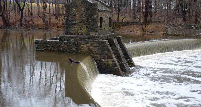
Historic Speedwell Lake Dam on Patriots Path, in Morristown, NJ with the remains of an 18th century iron works opposite the dam;.

Tree Limbs After Rain, Overlooking Speedwell Lake. Photo by David Veasey.
Location: 10 Towns; NJ Just S of Morristown at Morristown Nat. Hist. Park.
- States: New Jersey
- Counties: Morris
Patriots' Path is a developing network of hiking, biking, and equestrian trails, as well as green open spaces that span across Morris County. Originally conceived in 1968, Patriots' Path provides opportunities for light outdoor recreation while protecting and enhancing the environmental and aesthetic integrity of streams, valleys, and uplands. Patriots' Path links several dozen federal, state, county, and municipal parks, watershed lands, historic sites, and other points of interest across southern Morris County.
Stretching from East Hanover where it connects with the Lenape Trail in Essex County, Patriots' Path currently extends as far as Allamuchy Mountain State Park in Sussex County, and the Village of High Bridge in Hunterdon County.
Accessibility Information
No text provided.
Allowed Uses:
Bicycling Equestrian Hiking/WalkingPublic Contact
Albert KentMorris County Park Commission
P.O. Box 1295
Morristown, NJ 7962
[email protected] • (973) 326-7600
www.morrisparks.ne
Contact the trail manager for current maps and visiting details.
More Details
- Elevation (low): 180
- Elevation (high): 1100
- Elevation (cumulative): --
- Part of a Trail System? No
- National Designations: Community Millenium
- State Designations: Component of State Trail System
- Surface (primary): Soil
- Surfaces (additional): Soil
- Tread Width (average): 36"
- Tread Width (minimum): --
- Running length (minimum): --
- Tread Grade (average, percent): 4
- Tread Grade (maximum): 15
- Running length (maximum): --
- Cross-slope (average, percent): --
- Cross-slope (maximum): --
- Running length (maximum): --
- Certified as an NRT
Aug 20, 1980

