Penitencia Creek Trail
check with the trail manager for updated details before visiting.
Penitencia Creek Trail
City, Town, or County
Backcountry Trail
Frontcountry Trail
Rail Trail
- Length
2.5 miles
- Elevation Gain
--
- Route Type
out & back
(1 review)
- Length
2.5 miles - Elevation Gain
-- - Route Type
out & back
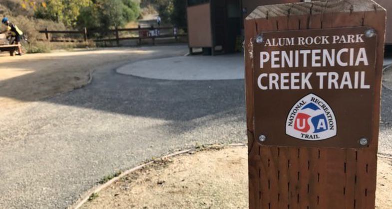
The Penitencia Creek Trail is located in the City of San Jose's Alum Rock Park. The trail runs along Penitencia Creek from the entrance of Alum Rock Park through the main area of the park and on to No Horse Bridge where it connects to the South Rim Switchback trail.

Photo by City of San Jose Parks.

Photo by City of San Jose Parks.

Photo by City of San Jose Parks.

Photo by City of San Jose Parks.
Location: San Jose (Alum Rock Park)6 miles NE of downtown
- States: California
- Counties: Santa Clara
The Alum Rock section of the Penitencia Creek Trail is located in the City of San Jose's Alum Rock Park. The existing trail was once the rail bed for the Peninsular Railroad during the early 1900s. The trail runs along Penitencia Creek from the entrance of Alum Rock Park through the main area of the park and onto No Horse Bridge where it connects to the South Rim Switchback trail. The trail provides a scenic 2.5-mile walk through the shaded canyon floor and connects with several trails that lead throughout Alum Rock Park. The route is also part of the Bay Area Ridge Trail.
Accessibility Information
No text provided.
Reviews
Vicki
The Section of Penitencia Creek Trail that’s in Alum Rock Park
The mostly tree covered creekside trail is cool on hottest days. Enjoy birdsong variety and smell sweet Bay trees and artemisia along the trail. Ticks and chiggers are around, repellant helps. Watch for speeding bikes on your way through the park, there’s a 15mph speed limit, bikes, too, the park is a wildlife sanctuary, but 15 and bike rules are ignored and there doesn’t seem to be any active enforcement. Bring water, I believe the only available drinking water is at the main entrance and visitor center. Modern bathrooms are at main entrance and older at visitor center (outhouse and vintage toilet are in second lot). Enjoy observing but don’t feed wildlife. Keep them safe by packing your trash when you leave. If bin is unavailable, please dispose trash at home. If you see something (smoking is banned) say something to rangers, fire risk is high. There are magnificent oaks and sycamores. Keep an eye up after springs to see hawk, owl, or occasional eagle. Heed signage, parts can be dangerous. The changing landscape, stonework, mini falls, clean air, flora and fauna make this an interesting and lovely trail. Final notes: trail continues outside of the park as well, between Penitencia Creek and Penitencia Creek Road, westward across White Road and to Penitencia Creek County Park where there is a large pond with ducks, fowl and a Wildlife Rescue Center resides. As of 10/11/2023 the park’s address on its official website remains not corrected, if you google it, it will misdirect you. It states ‘limited parking’ on Alum Rock Ave - incorrect and to direct that risks public and wildlife safety when parking is in fact minimal for 4 homes and across from them is an Emergency Access/Residential Service Road “lane”illegal to obstruct. The google map label Alum Rock Park ‘Parking’ needs edit to ‘main entrance’. Hold fast that the main entrance indeed is at the end of Penitencia Creek Rd and the road leading to it is safest for you and wildlife as safety improvements were made for residents and traffic there. It is in a patrol district. If the main entrance free lot is full, space is available on and off the rest of Penitencia Crk Rd leading up to it (before the speed humps section).
Allowed Uses:
Bicycling Equestrian Hiking/WalkingOther Activities
- Wildlife viewing / observation
Public Contact
Alum Rock Park Rangers15350 Penitencia Creek Rd
San Jose, CA 95127
(408) 259-5477
Contact the trail manager for current maps and visiting details.
More Details
- Elevation (low): 300
- Elevation (high): 600
- Elevation (cumulative): --
- Part of a Trail System? No
- Surface (primary): Rock, crushed
- Surfaces (additional): Paved
- Tread Width (average): 127"
- Tread Width (minimum): --
- Running length (minimum): --
- Tread Grade (average, percent): --
- Tread Grade (maximum): 27
- Running length (maximum): --
- Cross-slope (average, percent): --
- Cross-slope (maximum): --
- Running length (maximum): --
- Certified as an NRT
Oct 25, 1973

