Piestewa Peak Summit Trail
check with the trail manager for updated details before visiting.
Piestewa Peak Summit Trail
City, Town, or County
Backcountry Trail
- Length
1.2 miles
- Elevation Gain
--
- Route Type
out & back
(1 review)
- Length
1.2 miles - Elevation Gain
-- - Route Type
out & back
The Piestewa Peak Summit Trail is an out and back trail that leads to successful hikers with a three-hundred-sixty-degree view of the Phoenix metropolitan area.

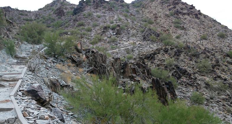
Piestewa Peak - second part of the trail. Photo by Jim Walla.

Photo by Wikipedia.

Piestewa Peak - view from peak - yellow line marks North Mountain, another National Recreation Trail. Photo by Jim Walla.

Piestewa Peak - view of Phoenix from the peak - trail is in the foreground. Photo by Jim Walla.

Piestewa Peak - zoom of the peak from the spot of the picture labeled "almost to the top". Photo by Jim Walla.

Piestewa Peak - almost to the top, last section. Photo by Jim Walla.

Piestewa Peak - third part of the trail. Photo by Jim Walla.

Piestewa Peak - early part of the trail - switchbacks up to the ridge line. Photo by Jim Walla.

Piestewa Peak - trailhead sign. Photo by Jim Walla.
Location: In Phoenix, just E of Squaw Peak Freeway.
- States: Arizona
The Piestewa Peak Summit Trail is an out-and-back trail that leads to successful hikers with a three-hundred-sixty-degree view of the Phoenix metropolitan area. While short in length, a little over one mile, the trail is steep, and jagged, and consists of multiple switchbacks and modified steps with integrated sections of gravel and rock. This summit trail has been a Phoenix favorite for several decades and is internationally recognized among hiking communities. Water, parking, and restrooms are available at the base of the trail.
Accessibility Information
No text provided.
Reviews
Jim Walla
Piestewa Peak - February 12, 2018
This is an extremely popular hike that climbs a prominent mountain in Phoenix. The trailhead is marked with a sign that rates the trail"extremely difficult" (I attached a photo). I suspect the hot, dry weather of Phoenix is part of the reason for this rating. However, I was there in winter on a relatively cool day. As a matter of fact, the wind was howling at the top and it was quite chilly. The trail is steep and strenuous, but I would call it"difficult" vs."extremely difficult". There are no places where you need to use your hands to scramble up rocks and the descent was manageable even for my 58-yr old knees. I would imagine in the heat of summer this is a very different experience, but I think anyone who is fit can manage this trail. Views from the top are great. Only complaint about the trail is its popularity. I was there on a weekday and there were a lot of people on the trail. This is not a big detractor for me, but if you like solitude, this is not your hike.
Allowed Uses:
Hiking/WalkingPublic Contact
Phoenix Parks Dept2701 E. Squaw Peak
Phoenix, AZ 85040
(602) 262-7901
Contact the trail manager for current maps and visiting details.
More Details
- Elevation (low): --
- Elevation (high): --
- Elevation (cumulative): --
- Part of a Trail System? No
- Surface (primary): --
- Surfaces (additional): --
- Tread Width (average): 0"
- Tread Width (minimum): --
- Running length (minimum): --
- Tread Grade (average, percent): --
- Tread Grade (maximum):
- Running length (maximum): --
- Cross-slope (average, percent): --
- Cross-slope (maximum): --
- Running length (maximum): --
- Certified as an NRT
Jan 6, 1974

