Pine Ridge Trail
check with the trail manager for updated details before visiting.
Pine Ridge Trail
City, Town, or County
Backcountry Trail
- Length
2.6 miles
- Elevation Gain
--
- Route Type
Loop
(1 review)
- Length
2.6 miles - Elevation Gain
-- - Route Type
Loop
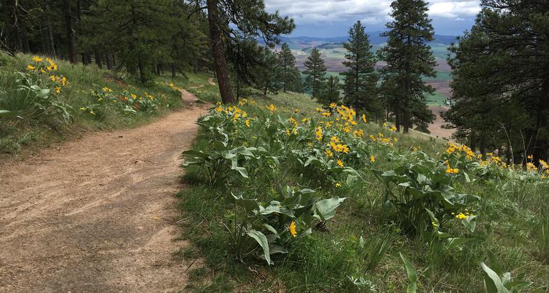
Wildflowers and great views of the Palouse Hills. Photo by Katie Rapp.

An abundance of wildflowers in the spring. Photo by Katie Rapp.
Location: Rural, Hwy 27 north.
- States: Washington
- Counties: Whitman
Trail treks through woods and dense underbrush. On reaching the vista the trees thin exposing the south side of the Butte and native bench grasses bordered by fields. The trail traverses the ridge with views and loops back down through dense woods.
Accessibility Information
No text provided.
Reviews
Katie Rapp
Fantastic views of the Palouse
The Pine Ridge Trail starts out in the dense trees. Climbing your way to the top along the southern side of the butte, you stay in the trees for the whole climb up. Once you reach the top, the trail meanders slightly downhill along the ridge and you get to experience the northern side of the butte, which is completely different from the south in that it has very few trees and is more reminiscent of the iconic Palouse hills. If you go in the spring, the southern side is teeming with wildflowers. As you make your way along the ridge, you are treated to sweeping views of the Palouse. The way back down to the parking lot contains moderately steep switchbacks back through the forest.
Allowed Uses:
No data provided.
Other Activities
- Wildlife viewing / observation
Public Contact
Roger MarcusWhitman Co. Parks & Recreation Dept.
310 N. Main St.
Colfax, WA 99111
(509) 397-6238
Contact the trail manager for current maps and visiting details.
More Details
- Elevation (low): 2900
- Elevation (high): 3600
- Elevation (cumulative): --
- Part of a Trail System? No
- Surface (primary): Soil
- Surfaces (additional): --
- Tread Width (average): --"
- Tread Width (minimum): --
- Running length (minimum): --
- Tread Grade (average, percent): --
- Tread Grade (maximum):
- Running length (maximum): --
- Cross-slope (average, percent): --
- Cross-slope (maximum): --
- Running length (maximum): --
- Certified as an NRT
Jan 3, 1980