Pinhoti Trails System
check with the trail manager for updated details before visiting.
Pinhoti Trails System
USDA Forest Service
Backcountry Trail
- Length
28 miles
- Elevation Gain
--
- Route Type
out & back
(1 review)
- Length
28 miles - Elevation Gain
-- - Route Type
out & back

Photo by Callie Thornton.

Photo by Callie Thornton.

Scenic view on trail. Photo by Callie Thornton.

Sunset on the trail. Photo by Callie Thornton.
Location: The Pinhoti Trail is located in the Talladega National Forest as well as Forever Wild, Alabama Forestry Commission, and Alabama State Park lands.
- States: Alabama
- Counties: Cleburne, Calhoun, Clay, Talladega, Cherokee, Coosa
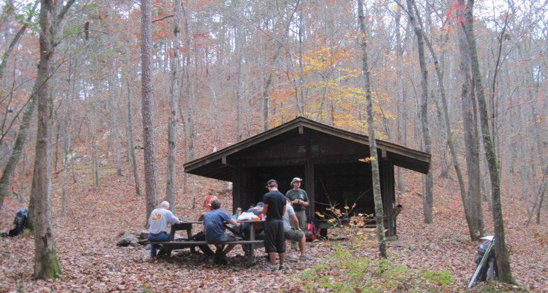
This trail features designated wilderness areas, mountainous rocky terrain, and steep grades in places. It meanders through mountains and valleys rich in history and legend, through rugged pine and hardwood forests, along ridge tops and through shady hollows and along mountain streams.
Accessibility Information
No text provided.
Reviews
Richard Smith
Beautiful Southern Appalachian Mountain Trail
The Alabama section of the Pinhoti's southern starting point is now on top of Flagg mountain at the historic tower and cabins. The tower and cabins were built by the CCC and are currently maintained by the Alabama hiking trail society. There is a new seven mile(+or-)woods section near Weogufka Coosa County Alabama. I have hiked numerous trails in the south and this is by far my favorite. If you want to hike a quiet and beautiful trail come to Alabama and experience the Pinhoti Trail.
Allowed Uses:
Hiking/WalkingOther Activities
- Camping
- Wildlife viewing / observation
Public Contact
Cheaha State ParkRoute 1
Delta, AL 36258
(334) 242-3334
www.alapark.com/cheaha-state-park
Contact the trail manager for current maps and visiting details.
More Details
- Elevation (low): --
- Elevation (high): --
- Elevation (cumulative): --
- Part of a Trail System? No
- Surface (primary): Soil
- Surfaces (additional): Soil
- Tread Width (average): 24"
- Tread Width (minimum): --
- Running length (minimum): --
- Tread Grade (average, percent): 8
- Tread Grade (maximum):
- Running length (maximum): --
- Cross-slope (average, percent): --
- Cross-slope (maximum): --
- Running length (maximum): --
- Certified as an NRT
Apr 21, 1977

