Pinnell Mountain Trail
check with the trail manager for updated details before visiting.
Pinnell Mountain Trail
Bureau of Land Management
Backcountry Trail
- Length
27.3 miles
- Elevation Gain
--
- Route Type
out & back
- Length
27.3 miles - Elevation Gain
-- - Route Type
out & back
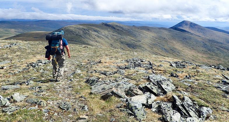
This NRT follows ridges above timberline in the vastness of interior Alaska.

Hiking over Pinnell Mountain toward Porcupine Dome, near Fairbanks Alaska. Photo by Teri Balser.


Location: 50 miles NE of Fairbanks on north side of AL 6.
- States: Alaska
- Counties: Southeast Fairbanks, Fairbanks North Star
The 27-mile Pinnell Mountain National Recreation Trail traverses alpine ridge lines and saddles. all above timberline. It allows access to outstanding natural resources associated with a high alpine tundra community.
The alpine tundra is the summer home of many different nesting birds, including Long-tailed Jaeger, Surfbird, Northern Wheatear (a Eurasian migrant), Horned Lark, and Gray-crowned Rosy-finch. These birds nest in typical trailside habitats and are exciting sightings for birders and wildlife watchers. Many different kinds of wildflowers abound during the summer when the 24-hour daylight of the midnight sun brings a spectrum of color to the lush greens of the tundra.
The trail is an excellent place to observe periglacial features associated with the discontinuous permafrost of the Yukin-Tanana Uplands.
Accessibility Information
No text provided.
Allowed Uses:
Dogs, on leash Hiking/WalkingOther Activities
- Camping
Public Contact
Teri BalserBureau of Land Management
Eastern Interior Field Office
Fairbanks, AK 99709
[email protected] • 907-474-2200
aurora.ak.blm.gov
Contact the trail manager for current maps and visiting details.
More Details
- Elevation (low): 3164
- Elevation (high): 4934
- Elevation (cumulative): --
- Part of a Trail System? No
- Surface (primary): Grass or Vegetation
- Surfaces (additional): Grass or Vegetation
- Tread Width (average): 24"
- Tread Width (minimum): --
- Running length (minimum): --
- Tread Grade (average, percent): 8
- Tread Grade (maximum): 39
- Running length (maximum): --
- Cross-slope (average, percent): --
- Cross-slope (maximum): --
- Running length (maximum): --
- Certified as an NRT
May 31, 1971

