Pittsburgh-to-Harrisburg Main Line Canal Greenway
check with the trail manager for updated details before visiting.
Pittsburgh-to-Harrisburg Main Line Canal Greenway
Private
Backcountry Trail
Frontcountry Trail
- Length
49.35 miles
- Elevation Gain
--
- Route Type
out & back
- Length
49.35 miles - Elevation Gain
-- - Route Type
out & back
Six NRT designations. For details please see 6-10 Trail, Juniata River Water Trail, Lower Trail, Path of the Flood, Roaring Run, West Penn.
Location: Pittsburgh to Harrisburg
- States: Pennsylvania
- Counties: Allegheny, Armstrong, Westmoreland
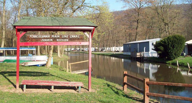
The Pittsburgh to Harrisburg Main Line Canal Greenway is a 320-mile-long corridor following the route of the historic Pennsylvania Main Line Canal. It is comprised of six completed sections of land-based trails totaling nearly 50 miles in length as well as the 142-mile-long Juniata River Water Trail. In addition to the Greenway components, it connects with the Appalachian, Link, and Mid-State hiking trails. Its component sections are managed by local government authorities, non-profit trails, watershed and heritage organizations, and the National Park Service. It provides access to fisheries, Audubon-designated Important Bird Areas, historical remnants of the canal and charcoal iron eras, and recreational assets across a wide section of south-central and southwestern Pennsylvania.
Accessibility Information
No text provided.
Allowed Uses:
Bicycling Boating, human-powered Dogs, on leash Equestrian Hiking/Walking Snow, cross-country skiingOther Activities
- Camping
- Fishing
- Snow, snow play general
- Wildlife viewing / observation
Public Contact
Karl KingAllegheny Ridge Corporation
1421-1427 12th Ave.
Altoona, PA 16603
[email protected] • (814) 940-1922
www.alleghenyridge.org
Contact the trail manager for current maps and visiting details.
More Details
- Elevation (low): 335
- Elevation (high): 2430
- Elevation (cumulative): --
- Part of a Trail System? No
- National Designations: Legacy Millenium
- Surface (primary): Boardwalk
- Surfaces (additional): --
- Tread Width (average): 96"
- Tread Width (minimum): --
- Running length (minimum): --
- Tread Grade (average, percent): 3
- Tread Grade (maximum): 20
- Running length (maximum): --
- Cross-slope (average, percent): --
- Cross-slope (maximum): --
- Running length (maximum): --
- Certified as an NRT
May 25, 2009


