Pomeroy and Newark Rail Trail
check with the trail manager for updated details before visiting.
Pomeroy and Newark Rail Trail
State
Backcountry Trail
Rail Trail
Urban Trail
- Length
4.18 miles
- Elevation Gain
--
- Route Type
out & back
- Length
4.18 miles - Elevation Gain
-- - Route Type
out & back
The Pomeroy and Newark Rail Trail is a year-round accessible paved pathway that runs north-south in Newark and in White Clay Creek State Park on an independent right-of-way of the former Pomeroy Railroad. It connects to the James F. Hall Trail (a designated National Recreation Trail), which runs east-west in Newark along the Amtrak Rail corridor, and also connects to the network of trails in White Clay Creek State Park.

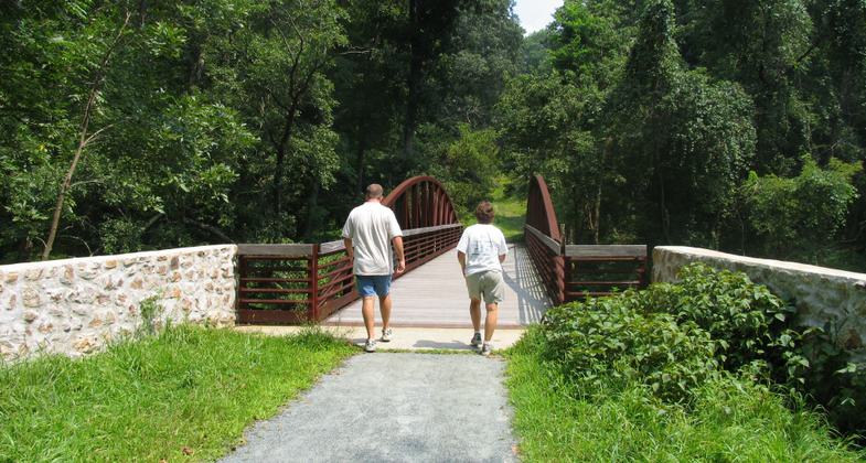
Walking over a pedestrian bridge on the Pomeroy and Newark Rail Trail. Photo by Avery Dunn.

Many animals call White Clay Creek State Park home. Photo by Avery Dunn.

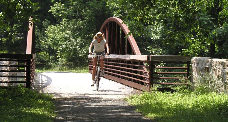
Biker on the Pomeroy Trail in White Clay Creek State Park. Photo by Avery Dunn.
Location: Connects White Clay Creek State Park, DE with the city of Newark's James F. Hall Trail, a designated National Recreation Trail. Portions run along White Clay Creek, a designated National Wild & Scenic River, and through the city of Newark, Delaware.
- States: Delaware
- Counties: New Castle
- Cities/Townships: Newark
The Pomeroy and Newark Rail Trail opened on September 10, 2012, after 10 years in the making. The trail follows the route of the former Pomeroy Railroad that was abandoned in 1939. It is a fully paved, accessible, and lighted pathway that is open year-round. The trail includes three information kiosks to inform the public of the rail line's history. The trail runs north-south starting in White Clay Creek State Park at Hopkins Road and ends when it connects to the James F. Hall Trail, which runs east-west in Newark. The Pomeroy Trail is an urban trail that eventually blends into the natural setting of White Clay Creek State Park.
The Pomeroy and Newark Rail Trail is a means to encourage physical fitness, increase trail-related recreation, relieve traffic congestion, and possibly even draw some large-scale public events to the area. The trail is a way to improve pedestrian safety and mobility in Newark and the surrounding area and to promote cycling and non-motorized transportation. The trail connects to the Newark Transit Center at Main Street where the public can travel by bus to surrounding cities and towns. The trail runs adjacent to the University of Delaware Laird Campus which gives students easy access to the trail and park system. It can serve a million people who live within 20 miles of the trail, from the families who want to take a trip to the park, to the students who want to get to class on time. The trail provides a great opportunity for community members to get out of their cars and put on their walking or running shoes.
The Pomeroy and Newark Rail Trail is crucial in providing a connection between city parks, Newark's central business district, the University of Delaware, and White Clay Creek State Park. The long-term plan is to eventually use the trail to connect local parks, including the former Curtis Paper Mill Park, currently being designed for development, the Newark Reservoir, and William M. Redd, Jr. Park. The trail is the backbone of a 75-mile network of trials located in greater Newark.
The Pomeroy and Newark Rail Trail cost $4.7 million, 80 percent of which was funded through the Transportation Enhancement Program supported by Senator Tom Carper. Project partners included the City of Newark, the Department of Transportation, the University of Delaware, the Division of Parks and Recreation, University Courtyard Apartments, and Delaware Transit Corporation. The project design was done by Pennoni Associates Inc., and project construction was completed by Merit Construction Engineers.
Accessibility Information
No text provided.
Allowed Uses:
Bicycling Dogs, on leash Hiking/WalkingPublic Contact
Avery DunnDelaware State Parks
89 Kings Highway
Dover, DE 19904
[email protected] • (302) 739-9207
Contact the trail manager for current maps and visiting details.
More Details
- Elevation (low): 71
- Elevation (high): 118
- Elevation (cumulative): --
- Part of a Trail System? No
- National Designations: White Clay Creek is a Wild and Scenic River
- Surface (primary): Paved
- Surfaces (additional): Rock, crushed
- Tread Width (average): 120"
- Tread Width (minimum): 0
- Running length (minimum): --
- Tread Grade (average, percent): 4
- Tread Grade (maximum):
- Running length (maximum): --
- Cross-slope (average, percent): 0
- Cross-slope (maximum): --
- Running length (maximum): --
- Certified as an NRT
May 29, 2013


