Pony Express Trail
check with the trail manager for updated details before visiting.
Pony Express Trail
USDA Forest Service
Backcountry Trail
- Length
8 miles
- Elevation Gain
--
- Route Type
out & back
(1 review)
- Length
8 miles - Elevation Gain
-- - Route Type
out & back
The Pony Express Trail's legend has endured longer and stronger than the very short 18 month length of it's life.

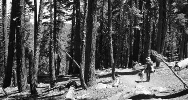
the trail to Cody Lake near Twin Bridges and Strawberry off Highway 50 in California (photo by Tova Jarvis).

1917 commemorative ride from Sacramento to South Lake Tahoe. Photo by Jeff Barker.
Location: Between Echo Summit and Pollock Pines.
- States: California
- Counties: El Dorado
Prior to 1851, mail from the United States took around 30 to 90 days to be delivered to the Gold Rush communities. The desire for even faster mail delivery led to the establishment of the Pony Express, which brought mail to California in a mere 10 days by individual riders on horseback. The Pony Express Trail from St. Joseph, Missouri, to Sacramento, California, was 1840 miles in length.
Mail service by the Pony Express began in April of 1860 to October of 1861 when the Union Telegraph line was completed. The Pony Express National Historic Trail was established in 1992 to preserve the trail and commemorate those who rode it.
There are 19 miles of the trail in the Eldorado National Forest, eight of which are designated as an NRT and parallel Highway 50. Access Points for the Pony Express Trail are Echo Summit, Wrights Lake Road, Webber Mill Rd., Peavine Ridge Road, and at the end of Bryan Meadow Road (11N09A) near the entrance to Sierra At Tahoe Ski Area. This trail is open to equestrians, bicyclists, and hikers. Motorized use is not allowed.
Accessibility Information
No text provided.
Reviews
Deb Glauz
Pony Express Trail Strawberry to Wright's Road along HWY 50.
I have hiked this trail numerous times over the last several years. Noticed on September 24th, 2022, much degradation from Caldor Fire and apparent lack of use. Trail is blocked often by large downed trees, and just disappears in many places. The XP markers are mostly gone or badly burned. I hope this section of the trail be restored.
Allowed Uses:
Dogs, on leash Hiking/WalkingPublic Contact
Lester LubetkinEl Dorado National Forest
100 Forni Rd.
Placerville, CA 95667
(503) 622-5061
Contact the trail manager for current maps and visiting details.
More Details
- Elevation (low): --
- Elevation (high): --
- Elevation (cumulative): --
- Part of a Trail System? No
- Surface (primary): --
- Surfaces (additional): --
- Tread Width (average): 0"
- Tread Width (minimum): --
- Running length (minimum): --
- Tread Grade (average, percent): --
- Tread Grade (maximum):
- Running length (maximum): --
- Cross-slope (average, percent): --
- Cross-slope (maximum): --
- Running length (maximum): --
- Certified as an NRT
Nov 26, 1979

