Potawatomi-Gorge Falls Trail
This information is a public record of the 1978 NRT application and may be out of date if it has not been updated by a trail manager --
check with the trail manager for updated details before visiting.
check with the trail manager for updated details before visiting.
Potawatomi-Gorge Falls Trail
USDA Forest Service
Backcountry Trail
- Length
0.5 miles
- Elevation Gain
--
- Route Type
out & back
- Length
0.5 miles - Elevation Gain
-- - Route Type
out & back
Location: N of Bessemer on SR 513, parking lot on R before lakefront.
- States: Michigan
- Counties: Gogebic
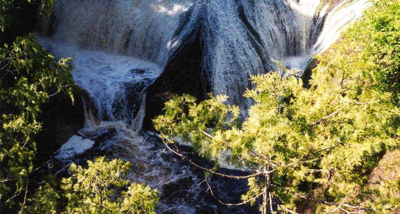
The Potawatomi-Gorge Trail provides access from the Black River National Scenic Byway to two unique water falls along the Black National Wild and Scenic River and also provides access to the North Country Natural Scenic Trail. A portion of this trail is accessible and provides access for persons with disabilities to a watchful observer.
Accessibility Information
No text provided.
Allowed Uses:
Hiking/WalkingPublic Contact
Recreational Staff OfficerUS Forest Service
Ottawa NF
Ironwood, MI 49938
[email protected] • (906) 932-1330
www.fs.fed.us/r9/ottawa
Contact the trail manager for current maps and visiting details.
More Details
- Elevation (low): 1400
- Elevation (high): 1500
- Elevation (cumulative): --
- Part of a Trail System? No
- Surface (primary): --
- Surfaces (additional): --
- Tread Width (average): 36"
- Tread Width (minimum): --
- Running length (minimum): --
- Tread Grade (average, percent): 3
- Tread Grade (maximum): 15
- Running length (maximum): --
- Cross-slope (average, percent): --
- Cross-slope (maximum): --
- Running length (maximum): --
- Certified as an NRT
Dec 7, 1978


