Presque Isle State Park Multi-purpose Trail
This information is a public record of the 1989 NRT application and may be out of date if it has not been updated by a trail manager --
check with the trail manager for updated details before visiting.
check with the trail manager for updated details before visiting.
Presque Isle State Park Multi-purpose Trail
State
Urban Trail
- Length
9.6 miles
- Elevation Gain
--
- Route Type
out & back
- Length
9.6 miles - Elevation Gain
-- - Route Type
out & back

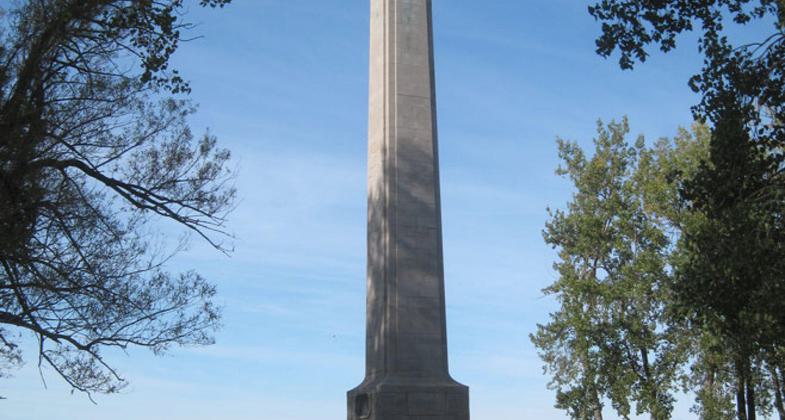
The Perry Monument marks the northern end of the Erie to Pittsburgh Trail. Photo by Mary Shaw.

Presque Isle Trail - 7-9-18. Photo by Jim Walla.

Presque Isle Trail - 7-9-18. Photo by Jim Walla.
Location: Urban/Suburban
- States: Pennsylvania
The trail is very popular with a wide range of users and runs along the coast shore across pier, and finishes up at Perry Monument
Accessibility Information
No text provided.
Allowed Uses:
Bicycling Dogs, on leash Hiking/Walking Snow, cross-country skiing Snow, snowshoeingOther Activities
- Camping
- Fishing
- Snow, snow play general
- Wildlife viewing / observation
Public Contact
Harry Z. LeslieBureau of State Parks
Presque Isle State Park
Erie, PA 16505
[email protected] • (814) 833-7424
Contact the trail manager for current maps and visiting details.
More Details
- Elevation (low): --
- Elevation (high): --
- Elevation (cumulative): --
- Part of a Trail System? No
- Surface (primary): Paved
- Surfaces (additional): Paved
- Tread Width (average): 8"
- Tread Width (minimum): --
- Running length (minimum): --
- Tread Grade (average, percent): --
- Tread Grade (maximum):
- Running length (maximum): --
- Cross-slope (average, percent): --
- Cross-slope (maximum): --
- Running length (maximum): --
- Certified as an NRT
Dec 4, 1989

