Quinebaug River Water Trail
check with the trail manager for updated details before visiting.
Quinebaug River Water Trail
Nonprofit
Water Trail (other)
- Length
45 miles
- Elevation Gain
--
- Route Type
out & back
- Length
45 miles - Elevation Gain
-- - Route Type
out & back
The Quinebaug River Water Trail offers 45 miles of paddling within an hour's drive of three of New England's largest urban regions. Many of the segments provide an opportunity for family-friendly, close-to-home outdoor adventures with a surprisingly remote feel; wildlife is abundant and the only traces of civilization are the remnants of old mills.

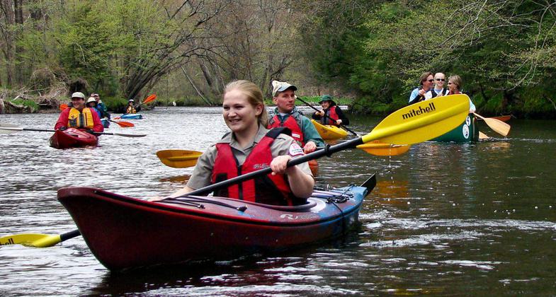
Quinebaug Paddling. Photo by A. Dabrowski. Photo by Alan Dabrowski

Enjoying Quinebaug From Ross Hill Park. Photo by Heather Able.


Canoe and kayak launch. Photo by US Army Corp of Engineers.

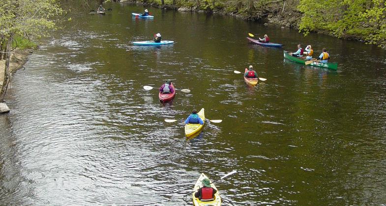
Going Down the Quinebaug. Photo by US Army Corp of Engineers.

North View from West Thompson Lake Boat Ramp. Photo by US Army Corp of Engineers.

View of West Thompson Lake from the dam. Photo by US Army Corp of Engineers.

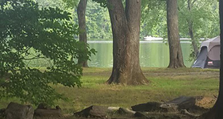
West Thompson Lake Boat Ramp Parking Lot. Photo by US Army Corp of Engineers.

Fabyan Canoe Launch. Photo by US Army Corp of Engineers.

Location: Northeastern Connecticut and adjacent area in Massachusetts. It begins in Holland, Massachusetts and ends in Canterbury, Connecticut.
- States: Connecticut, Massachusetts
- Counties: Hampden, Worcester, Windham
- Cities/Townships: MA: Holland, Sturbridge, Southbridge and Dudley. CT: Thompson, Putnam, Pomfret, Killingly, Plainfield, Canterbury
The Quinebaug River Water Trail offers 45 miles of paddling within an hour's drive of three of New England's largest urban regions. Many of the segments provide an opportunity for family-friendly, close-to-home outdoor adventures with a surprisingly remote feel; wildlife is abundant and the only traces of civilization are the remnants of old mills.
The Quinebaug River Water Trail flows through The Last Green Valley National Heritage Corridor and within the Quinebaug and Shetucket rivers valley known as a relatively undeveloped rural enclave in the midst of the most urbanized region in the nation. The Last Green Valley is 77% forest and farmland and appears distinctively dark at night when viewed from satellites or aircraft. The Quinebaug and Shetucket Rivers eventually combine to become the Thames River, creating the third-largest watershed emptying into Long Island Sound.
Within the corridor are several US Army Corps of Engineers flood control projects. The Corps led the way by nominating two of the following segments as NRTs before the rest of the river was nominated.
Six water trail segments on the Quinebaug River provide almost 45 miles of paddling. Note that not all segments are contiguous due to impassable dams.
1. Holland Pond (Lake Siog) in Holland, MA, to East Brimfield Lake, Sturbridge, MA (4.6 miles) [Designated an NRT in 2007];
2. Paper Mill Pond in Dudley, MA, to Fabyan, West Thompson, CT (5.5 miles);
3. Fabyan in West Thompson, CT to West Thompson Lake, W. Thompson, CT (5.8 miles) [Designated an NRT in 2011];
4. Simonzi Park in Putnam, CT, to Route 101 in Pomfret, CT (6.5 miles);
5. Brooklyn Riverside Park in Brooklyn, CT, upriver to Rogers Dam (4.8 miles); and
6. Wayne R Lafreniere Canoe Launch in Killingly, CT, to the CT DEEP Fish Hatchery in Plainfield, CT, Robert Manship Park in Canterbury, CT, and Butts Bridge in Canterbury, CT (15.5 miles).
The Last Green Valley, Inc. and the US Army Corps of Engineers partner with the Willimantic River Alliance, federal and state agencies, non-profits, riverside towns, and paddlers to promote enjoyment and stewardship of the Quinebaug River. An active Water Trails Steering Committee has developed stewardship plans and paddlers guides, made launch site improvements, and hosted public events to raise public awareness and increase recreational use. Other water trails that have been developed in the greater Thames River watershed include the Willimantic National River Water Trial and the Shetucket National River Water Trail.
Accessibility Information
No text provided.
Allowed Uses:
Boating, human-powered SwimmingOther Activities
- Camping
- Fishing
- Wildlife viewing / observation
Public Contact
Bill ReidThe Last Green Valley, Inc.
P.O. Box 29
Danielson, CT 06239
[email protected] • (860) 774-3300
www.tlgv.org
More Details
- Elevation (low): 118
- Elevation (high): 670
- Elevation (cumulative): --
- Part of a Trail System? No
- National Designations: Two NRT segments, National Heritage Corridor
- State Designations: Connecticut State Greenway (portion)
- Surface (primary): Water, slow moving
- Surfaces (additional): Water, slow moving, Water, calm
- Tread Width (average): 0"
- Tread Width (minimum): 0
- Running length (minimum): --
- Tread Grade (average, percent): --
- Tread Grade (maximum):
- Running length (maximum): --
- Cross-slope (average, percent): 0
- Cross-slope (maximum): --
- Running length (maximum): --
- Certified as an NRT
May 19, 2011


