Rainy Lake Trail
check with the trail manager for updated details before visiting.
Rainy Lake Trail
- Length
0.2 miles - Elevation Gain
-- - Route Type
out & back
This forested trail is fully accessible.
Location: 35 mi. W of Winthrop on SR 20.
- States: Washington
- Counties: Chelan
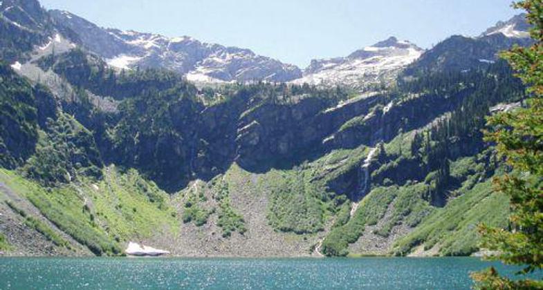
This forested trail is fully accessible. This is an easy, paved trail with no elevation gain. The trail leaves the parking lot and contours around a sidehill to reach the north end of Rainy Lake, where the trail ends at the paved picnic spot with benches. High cliffs surround the lake, with waterfalls cascading down to the lake. In the fall, the golds and reds of the changing shrubs and trees are spectacular. The walk to the lake takes only 20 minutes and is a refreshing break for those driving the North Cascades Highway. This trail gets heavy use. Visitors should be careful to stay on the trail to avoid damaging fragile areas.
Accessibility Information
No text provided.
Allowed Uses:
Swimming Dogs, on leash Hiking/WalkingOther Activities
- Camping
- Fishing
Public Contact
Jim HammerOkanogan National Forest
Methow Valley Ranger District
Winthrop, WA 98862
(509) 996-4017
Contact the trail manager for current maps and visiting details.
More Details
- Elevation (low): --
- Elevation (high): --
- Elevation (cumulative): --
- Part of a Trail System? No
- Surface (primary): --
- Surfaces (additional): --
- Tread Width (average): 48"
- Tread Width (minimum): --
- Running length (minimum): --
- Tread Grade (average, percent): --
- Tread Grade (maximum):
- Running length (maximum): --
- Cross-slope (average, percent): --
- Cross-slope (maximum): --
- Running length (maximum): --
- Certified as an NRT
Oct 21, 1977


