Ralph L. Thayer Memorial
check with the trail manager for updated details before visiting.
Ralph L. Thayer Memorial
USDA Forest Service
Backcountry Trail
- Length
17 miles
- Elevation Gain
--
- Route Type
out & back
- Length
17 miles - Elevation Gain
-- - Route Type
out & back
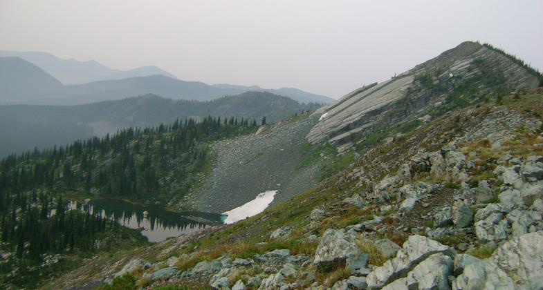
High mountain alpine setting - ridge tops views of Glacier National Park, flathead valley
Location: Flathead National Forest
- States: Montana
- Counties: Flathead
The Whitefish Divide Trail (Ralph Thayer Memorial Trail) follows the western border of Glacier View Ranger District. The southern trailhead begins just south of Werner Peak Lookout and is accessed from road #1658. For backpackers, water is located in China Basin and in wetlands to the north for about 2 miles. There is also a creek at Haines Pass. Water is scarce on the rest of the trail so plan accordingly. Portions of this trail are very steep and while easy to navigate, junctions are not well marked. Ridge walks are marked by rock cairns where the trail is not as apparent. The trail crosses the road near Red Meadow Campground. This northern section of the trail is less traveled. The trail is open for non-motorized uses.
Accessibility Information
No text provided.
Allowed Uses:
Bicycling Dogs, on leash Equestrian Snow, cross-country skiing Snow, snowshoeingOther Activities
- Camping
- Snow, snow play general
- Wildlife viewing / observation
Public Contact
Fred FlintUS Forest Service
Hungry Horse Ranger District
Hungry Horse, MT 59919
[email protected] • (406) 387-3800
Contact the trail manager for current maps and visiting details.
More Details
- Elevation (low): 6000
- Elevation (high): 7300
- Elevation (cumulative): --
- Part of a Trail System? No
- National Designations: National Millenium
- Surface (primary): Soil
- Surfaces (additional): Soil
- Tread Width (average): 18"
- Tread Width (minimum): --
- Running length (minimum): --
- Tread Grade (average, percent): 8
- Tread Grade (maximum): 20
- Running length (maximum): --
- Cross-slope (average, percent): --
- Cross-slope (maximum): --
- Running length (maximum): --
- Certified as an NRT
May 14, 1984


