Rancheria Falls National Recreation Trail
This information is a public record of the 1980 NRT application and may be out of date if it has not been updated by a trail manager --
check with the trail manager for updated details before visiting.
check with the trail manager for updated details before visiting.
Rancheria Falls National Recreation Trail
USDA Forest Service
- Length
1 mile
- Elevation Gain
--
- Route Type
out & back
- Length
1 mile - Elevation Gain
-- - Route Type
out & back
A two mile roundtrip hike to see the Falls. Season June through October (dependent upon snowfall).
Location: Huntington Lake, travel approximately 1 mile past China Peak Ski Resort, turn right on road 8S31. Trailhead is 1.2 miles up the Rancheria Falls road (8S31).
- States: California
- Counties: Fresno
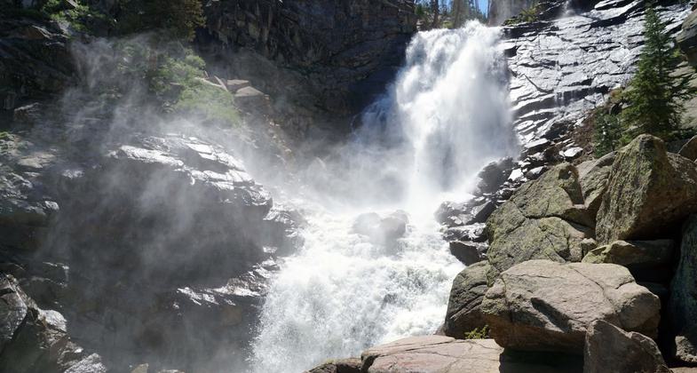
The trail is of gentle grade. Steep at the base of the Falls. Climbing around the rocks or to the top of the falls is not recommended due to the steep slope and slippery rocks. During the summer the falls are spectacular. Rancheria Falls is approximately 150' high and 50' wide. There are plenty of rocks on which to sit and have a snack or simply enjoy the beautiful surroundings.
Accessibility Information
No text provided.
Allowed Uses:
Hiking/WalkingPublic Contact
USDA Forest Service, Sierra National Forest1600 Tollhouse Road
Clovis, CA 93611
5592970706
www.fs.usda.gov/sierra
Contact the trail manager for current maps and visiting details.
More Details
- Elevation (low): 7200
- Elevation (high): 8120
- Elevation (cumulative): --
- Part of a Trail System? No
- Surface (primary): Soil
- Surfaces (additional): --
- Tread Width (average): 0"
- Tread Width (minimum): --
- Running length (minimum): --
- Tread Grade (average, percent): --
- Tread Grade (maximum):
- Running length (maximum): --
- Cross-slope (average, percent): --
- Cross-slope (maximum): --
- Running length (maximum): --
- Certified as an NRT
Dec 15, 1980


