Red Rock Water Trail
check with the trail manager for updated details before visiting.

Red Rock Water Trail
Private
National Water Trail
- Length
36 miles
- Elevation Gain
--
- Route Type
Loop
- Length
36 miles - Elevation Gain
-- - Route Type
Loop
The 36-mile Red Rock Water Trail is located on Lake Red Rock near Pella and Knoxville, Iowa. The loop can be paddled in its entirety or broken up into shorter sections. The water trail features 8 access points, which are conveniently close to the many campgrounds around the lake. Most of the campgrounds are equipped with shower facilities and electrical hookups.
Location: The Red Rock Water Trail is located on Lake Red Rock, which is part of the Des Moines River. The Water Trail is close to the Iowa towns of Knoxville, Pella and Pleasantville in Marion county.
- States: Iowa
- Counties: Marion
- Cities/Townships: No current cities. On top of where the historical towns of Red Rock and Cordova once stood
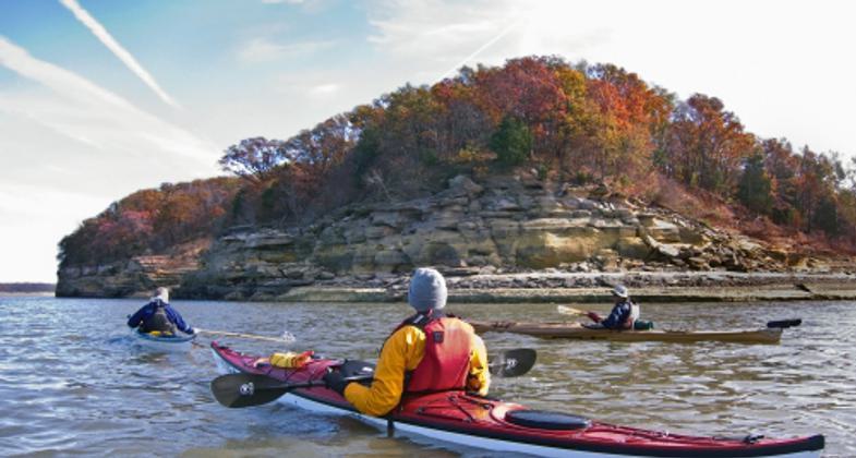
The Red Rock Water Trail is a 36-mile loop on scenic Lake Red Rock. It can be paddled as a whole or broken into sections and includes many types of paddling: sheltered coves for beginners, as well as open water with long crossings, and wide fetches that can produce large waves for intermediate and advanced paddlers.
Moonlight paddlers are also welcome to explore the trail by night. There are 8 access points that are in close proximity to the many campgrounds and historic sites. Most campgrounds have shower and restroom facilities, electrical hookups, and most are close to playgrounds or beaches. Hickory Ridge is a hike or paddle-in-only camp, and the only primitive campground in Iowa. Lake Red Rock is a great place for learning about history and the environment.
Paddlers have magnificent views of the sandstone bluffs as they travel the trail, and can watch the many species of birds and wildlife. Fossils and plant species are fun to find, and fishing on the lake is both challenging and rewarding.
The lake was built over the town of Red Rock, which was a lawless frontier town on the edge of civilization in the mid-1800s and has many historical stories to discover. Peace Tree Stump was said to be a settler and Indian trading post, and Horn's Ferry bridge was the first wagon bridge in the county to cross the Des Moines River. Visitors have the opportunity to use a GPS and paddle to the exact location of abandoned towns below the water.
Accessibility Information
No text provided.
Allowed Uses:
Boating, motorized Boating, human-powered SwimmingOther Activities
- Camping
- Fishing
- Heritage and history
- Wildlife viewing / observation
Public Contact
Diane LowryRed Rock Lake Association
P. O. Box 292
Pella, IA 50219
[email protected] • (641) 828-7522
Contact the trail manager for current maps and visiting details.
More Details
- Elevation (low): --
- Elevation (high): --
- Elevation (cumulative): --
- Part of a Trail System? No
- State Designations: Iowa's largest lake; 892.9 total miles/designated
- Surface (primary): --
- Surfaces (additional): Rock, boulders, Rock, smooth, Snow or ice, Water, calm
- Tread Width (average): 0"
- Tread Width (minimum): 0
- Running length (minimum): --
- Tread Grade (average, percent): --
- Tread Grade (maximum):
- Running length (maximum): --
- Cross-slope (average, percent): 0
- Cross-slope (maximum): --
- Running length (maximum): --
- Certified as an NRT
Sep 30, 2013


