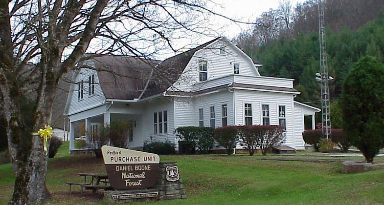
Redbird Fitness Trail
check with the trail manager for updated details before visiting.
Redbird Fitness Trail
USDA Forest Service
Urban Trail
- Length
0.25 miles
- Elevation Gain
--
- Route Type
Loop
- Length
0.25 miles - Elevation Gain
-- - Route Type
Loop
The Redbird Fitness Trail is located at the Redbird Ranger Station.
Location: Daniel Boone National Forest, Peabody, Kentucky
- States: Kentucky
- Counties: Clay
The trail is a loop trail beginning at the Ranger Station. The trail has exercise stations with descriptions of the exercise to be done at that station using the facilities located there.
One of the most significant federal land purchase programs after World War II was the Red Bird Purchase Unit in Kentucky. Most of the land was acquired during the late 1960s and early 1970s. These lands today are part of the Redbird Ranger District of the Daniel Boone National Forest. Congressional legislation in the 1890s authorized the creation of national forests from land in the public domain.
The trail was constructed by Youth Conservation Corps workers to standards established in the brochure produced by the Equipment Development Center in Missoula, Montana.
Accessibility Information
No text provided.
Allowed Uses:
Hiking/WalkingPublic Contact
USDA Forest Service, Redbird Ranger District91 Peabody Rd
Big Creek, KY 40914
(606) 598-2192
www.fs.usda.gov/detail/dbnf/about-forest/districts/?cid=fsbdev3_032
Contact the trail manager for current maps and visiting details.
More Details
- Elevation (low): --
- Elevation (high): --
- Elevation (cumulative): --
- Part of a Trail System? No
- Surface (primary): Wood chips/mulch
- Surfaces (additional): --
- Tread Width (average): --"
- Tread Width (minimum): --
- Running length (minimum): --
- Tread Grade (average, percent): --
- Tread Grade (maximum):
- Running length (maximum): --
- Cross-slope (average, percent): --
- Cross-slope (maximum): --
- Running length (maximum): --
- Certified as an NRT
Oct 24, 1979


