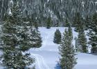
Refuge Point Cross Country Ski
This information is a public record of the 1980 NRT application and may be out of date if it has not been updated by a trail manager --
check with the trail manager for updated details before visiting.
check with the trail manager for updated details before visiting.
Refuge Point Cross Country Ski
USDA Forest Service
- Length
4 miles
- Elevation Gain
--
- Route Type
out & back
- Length
4 miles - Elevation Gain
-- - Route Type
out & back
Fantastic, cold snow cross-country skiing and snowshoeing in the Madison Earthquake River Canyon Area.

Snowshoe walk at Refuge Point. Photo by USFS-Custer Gallatin NF.

Interpretive signs greet the visitor at Refuge Point Trailhead. Photo by USFS-Custer Gallatin NF.
Location: In Gallatin NF, N of Earthquake Lake on SR 287.
- States: Montana
- Counties: Gallatin
Refuge Point gets its name from the 1959 earthquake. There was a landslide at the Madison River Canyon that caused people to go up to the ridge, which is the trail's namesake. When snowshoeing along the trail, you can read more about the 1959 earthquake and stop by the Visitor Center, which is conveniently located right down the road from the Refuge Point trailhead. The Visitor Center is open from June to October.
Accessibility Information
No text provided.
Allowed Uses:
Hiking/WalkingPublic Contact
Ron NaberUS Forest Service
PO Box 520
West Yellowstone, MT 59758
[email protected] • (406) 823-6961
www.fs.fed.us/r1/gallatin
Contact the trail manager for current maps and visiting details.
More Details
- Elevation (low): 6500
- Elevation (high): 6500
- Elevation (cumulative): --
- Part of a Trail System? No
- Surface (primary): Snow or ice
- Surfaces (additional): --
- Tread Width (average): 36"
- Tread Width (minimum): --
- Running length (minimum): --
- Tread Grade (average, percent): 2
- Tread Grade (maximum): 5
- Running length (maximum): --
- Cross-slope (average, percent): --
- Cross-slope (maximum): --
- Running length (maximum): --
- Certified as an NRT
Dec 15, 1980

