Ridge Runner Trail
This information is a public record of the 1980 NRT application and may be out of date if it has not been updated by a trail manager --
check with the trail manager for updated details before visiting.
check with the trail manager for updated details before visiting.
Ridge Runner Trail
USDA Forest Service
Backcountry Trail
- Length
22 miles
- Elevation Gain
--
- Route Type
out & back
- Length
22 miles - Elevation Gain
-- - Route Type
out & back
Location: In Mark Twain NF connects Noblett Lake and North Fork trailheads.
- States: Missouri
- Counties: Douglas, Howell
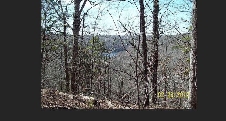
The Ridge Runner Trail extends from Noblett Lake to the North Fork Recreation Area and travels through the rough, beautiful Missouri Ozarks. The diverse vegetation along the trail includes native wildflowers and remnant prairie species, oak-hickory, shortleaf pine, and bottomland forests. The eight-mile loop trail around Noblett Lake, the twelve-mile loop in Steam Mill Hollow, and the Ozark Trail offer other hiking opportunities.
Accessibility Information
No text provided.
Allowed Uses:
Dogs, on leash Hiking/WalkingOther Activities
- Camping
Public Contact
Mark Twain National ForestAva/Cassville/Willow Springs Ranger District .
Ava, MO 65608
[email protected] • (417) 683-4428
www.fs.fed.us/r9/forests/marktwain/recreation/sites/ridge_runner/+
Contact the trail manager for current maps and visiting details.
More Details
- Elevation (low): --
- Elevation (high): --
- Elevation (cumulative): --
- Part of a Trail System? No
- Surface (primary): Snow or ice
- Surfaces (additional): Snow or ice
- Tread Width (average): 18"
- Tread Width (minimum): --
- Running length (minimum): --
- Tread Grade (average, percent): 12
- Tread Grade (maximum):
- Running length (maximum): --
- Cross-slope (average, percent): --
- Cross-slope (maximum): --
- Running length (maximum): --
- Certified as an NRT
Jan 31, 1980


