Rim Trail
This information is a public record of the 1978 NRT application and may be out of date if it has not been updated by a trail manager --
check with the trail manager for updated details before visiting.
check with the trail manager for updated details before visiting.
Rim Trail
USDA Forest Service
- Length
13 miles
- Elevation Gain
--
- Route Type
out & back
- Length
13 miles - Elevation Gain
-- - Route Type
out & back
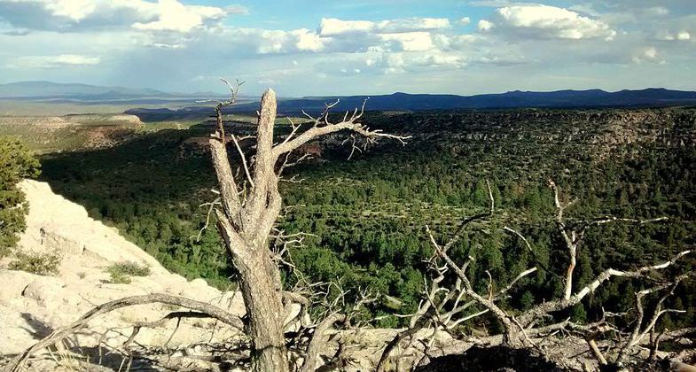
Located on western rim of NM's Sacramento Mountains, the Rim Trail winds through pine and fir trees, quaking aspen and meadows.
Location: At Slide Group Area on Sunset Rd off US 82 21 mi. E of Alamogordo.
- States: New Mexico
Located on western rim of NM's Sacramento Mountains, the Rim Trail winds through pine and fir trees, quaking aspen and meadows. Several access points from Hwy 6563.
Accessibility Information
No text provided.
Allowed Uses:
Dogs, on leash Hiking/WalkingOther Activities
- Camping
Public Contact
Max. E. GoodwinLincoln National Forest
Sacremento Ranger District
Cloudcroft, NM 88317
(505) 682-2551
Contact the trail manager for current maps and visiting details.
More Details
- Elevation (low): --
- Elevation (high): --
- Elevation (cumulative): --
- Part of a Trail System? No
- Surface (primary): --
- Surfaces (additional): --
- Tread Width (average): 24"
- Tread Width (minimum): --
- Running length (minimum): --
- Tread Grade (average, percent): --
- Tread Grade (maximum):
- Running length (maximum): --
- Cross-slope (average, percent): --
- Cross-slope (maximum): --
- Running length (maximum): --
- Certified as an NRT
Nov 2, 1978


