River Bluff Trail
check with the trail manager for updated details before visiting.
River Bluff Trail
Other Federal
Backcountry Trail
- Length
3.1 miles
- Elevation Gain
--
- Route Type
Loop
(1 review)
- Length
3.1 miles - Elevation Gain
-- - Route Type
Loop
This is a great trail for observing a large variety of wildflowers in a small area including several rare species.

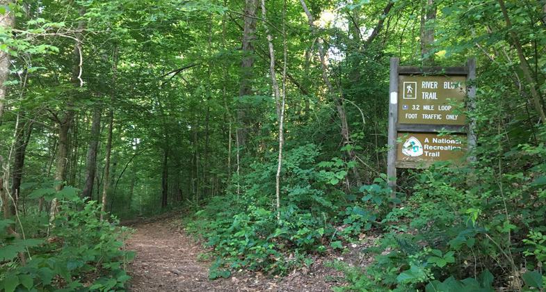
Entrance to the River Bluff Trail. Photo by Donna Kridelbaugh.

Winner 2022 NRT Photo Contest, Environmental Features, Flora, and Fauna. Photo by Melinda Watson.

Loop segment starts with upper to the ridge line and lower along the river. Photo by Donna Kridelbaugh.

Norris Dam. Photo by lamjohnm.
Location: At Norris Dam Reservation on US 441 N of Bethel.
- States: Tennessee
- Counties: Anderson
This is a great trail for observing a large variety of wildflowers in a small area including several rare species. Rich pockets of wildflowers are scattered over the hillside, especially yellow trout lilies, celandine poppies, bloodroot, spring beauties, and toothwort. Bring your camera outfitted with a macro lens. If you are just learning to identify wildflowers, attend one of the annual wildflower walks held each spring. This trail is on the Norris Dam Reservation on the west side of the dam across the tailwaters from the Songbird Trail. Norris Dam is about 30 miles north of Knoxville, Tenn., off I-75, exit 122.
Accessibility Information
No text provided.
Reviews
Donna Kridelbaugh
NRT Ambassador Review
The River Bluff Trail is an approximately 3-mile loop, hiking-only trail located near the tail waters of Norris Dam on the Clinch River. The lower portion of the trail is flat and parallels the Clinch River, providing scenic views of the river landscape and dam in the distance. There is a moderate ascent to the upper portion of the loop trail that traverses the ridge line and along the River Bluff Small Wild Area. The trail is located in a less visited portion of the recreation area and provided a more private hiking experience. The trail was well-maintained and in excellent shape. There is a trash can located at the trailhead and ample parking spaces. While on the trail, please remember to leave no trace by packing out your trash and keeping it in good shape for us all to enjoy.
Allowed Uses:
Dogs, on leash Hiking/WalkingOther Activities
- Wildlife viewing / observation
Public Contact
Tennessee Valley AuthorityPublic Land Information Center
Norris, TN 37828
(800) 882-5263
www.tva.com/Environment/Environmental-Stewardship/Public-Lands-Info
Contact the trail manager for current maps and visiting details.
More Details
- Elevation (low): 588
- Elevation (high): 1220
- Elevation (cumulative): --
- Part of a Trail System? No
- Surface (primary): Soil
- Surfaces (additional): --
- Tread Width (average): 18"
- Tread Width (minimum): --
- Running length (minimum): --
- Tread Grade (average, percent): --
- Tread Grade (maximum): 18
- Running length (maximum): --
- Cross-slope (average, percent): --
- Cross-slope (maximum): --
- Running length (maximum): --
- Certified as an NRT
Jun 9, 1976

