Robert Frost Interpretive Trail
check with the trail manager for updated details before visiting.
Robert Frost Interpretive Trail
USDA Forest Service
- Length
1.2 miles
- Elevation Gain
--
- Route Type
out & back
(1 review)
- Length
1.2 miles - Elevation Gain
-- - Route Type
out & back
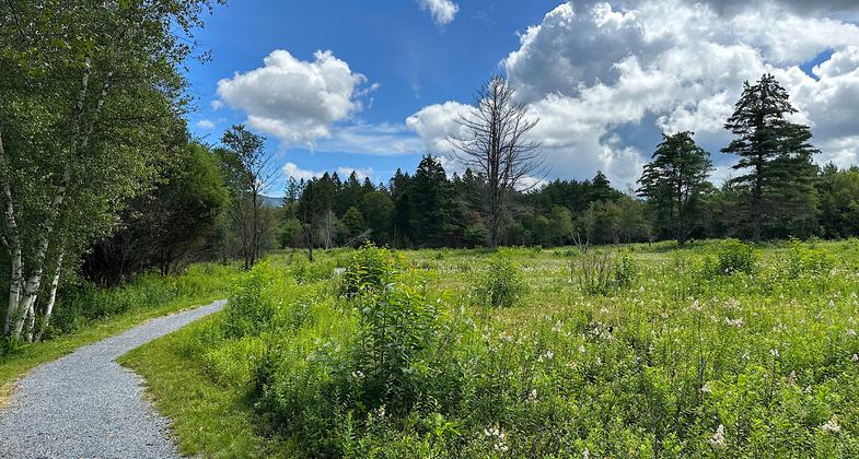
This National Recreation Trail commemorates Robert Frost’s poetry; several of his poems are mounted along the trail in the woods and fields.

Open field. Photo by Janie Walker

Robert Frost Trail - 10-9-2018. Photo by Jim Walla.

Robert Frost Trail - 10-9-2018. Photo by Jim Walla.

Trail commemorating Robert Frost's poetry. Photo by USFS.
Location: Green Mountain National Forest; Star Route 125, Robert Frost Memorial Highway. 2 mi. east of Ripton.
- States: Vermont
- Counties: Addison
This National Recreation Trail commemorates Robert Frost’s poetry; several of his poems are mounted along the trail in the woods and fields. Blueberries and huckleberries grow in an old field at the far end of the trail. The trail is an easy walk, and the first 0.3 miles across a beaver pond boardwalk out to the South Branch of the Middlebury River is accessible and suitable for wheelchairs. The Forest Service maintains all of the old fields along this trail with prescribed fire to preserve the scenic, open appearance of the area.
Accessibility Information
No text provided.
Reviews
Janie Walker
Beautiful landscapes, beautiful poetry
August 14, 2023. Well-maintained and popular one-mile hike through lovely woods and fields. Poetry displayed along the entire trail. Frost spent 23 summers in a small cabin nearby, and the trail features his poems so that the walker might experience “the feelings of the poet” as she views the landscapes. Blessed with a beautiful day and no bugs, I took my time along the trail and enjoyed the scenery, the poems, and the greetings of the many other hikers. Lots of parents with young kids out there and quite a few “older” couples. It was nice to see people of all ages ambling along. Note that there is some water damage to the trail in one small section. It is easy enough to avoid that though, even if you are using a wheelchair. Given how popular this trail is, I suspect the repairs to the trail will happen soon (VT has been deluged with an insane amount of rain lately).
Allowed Uses:
Dogs, on leash Hiking/WalkingOther Activities
- Fishing
Public Contact
Green Mountain National Forest231 N. Main St.
Rutland, VT 5701
(802) 747-6700
www.fs.fed.us/r9/gmfl
Contact the trail manager for current maps and visiting details.
More Details
- Elevation (low): 1300
- Elevation (high): 1320
- Elevation (cumulative): --
- Part of a Trail System? No
- National Designations: Watchable Wildlife
- Surface (primary): Rock, crushed
- Surfaces (additional): Rock, crushed
- Tread Width (average): 36"
- Tread Width (minimum): --
- Running length (minimum): --
- Tread Grade (average, percent): 5
- Tread Grade (maximum): 25
- Running length (maximum): --
- Cross-slope (average, percent): --
- Cross-slope (maximum): --
- Running length (maximum): --
- Certified as an NRT
Jun 28, 1979

