Rock Lake Trail
This information is a public record of the 1981 NRT application and may be out of date if it has not been updated by a trail manager --
check with the trail manager for updated details before visiting.
check with the trail manager for updated details before visiting.
Rock Lake Trail
USDA Forest Service
Backcountry Trail
- Length
13.6 miles
- Elevation Gain
--
- Route Type
Loop
- Length
13.6 miles - Elevation Gain
-- - Route Type
Loop
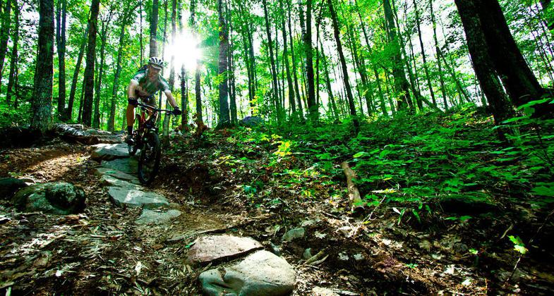
The Rock Lake Trail is great for hiking and mountain biking.

Chequamegon Area Mountain Bike Association rider. Photo by Leslie Kehmeier.

Dashing through the snow. Photo by Douglas Thompson.
Location: T 43N, R6W, Sections 19, 20, 29, 30. You can start at the parking lot off Hwy M, or for shorter hikes to lakes on the trail you can begin where the trail loops cross FR 207.
- States: Wisconsin
- Counties: Bayfield
The Rock Lake Trail is great for hiking and mountain biking. The trail winds through rolling terrain forested with oak, paper birch, aspen, and maple. There are stands of white pine scattered throughout the area as well as around Rock and Spring Lakes.
Accessibility Information
No text provided.
Allowed Uses:
Bicycling Hiking/Walking Snow, cross-country skiingOther Activities
- Snow, snow play general
Public Contact
Chad JacobsonChequamegon-Nicolet National Forest
Great Divide Ranger District
Hayward, WI 54843
[email protected] • (715) 634-4821
www.fs.fed.us/r9/cnnf
Contact the trail manager for current maps and visiting details.
More Details
- Elevation (low): 1420
- Elevation (high): 1530
- Elevation (cumulative): --
- Part of a Trail System? No
- Surface (primary): Soil
- Surfaces (additional): --
- Tread Width (average): 30"
- Tread Width (minimum): --
- Running length (minimum): --
- Tread Grade (average, percent): 15
- Tread Grade (maximum): 30
- Running length (maximum): --
- Cross-slope (average, percent): --
- Cross-slope (maximum): --
- Running length (maximum): --
- Certified as an NRT
Nov 17, 1981

