Rock River Water Trail
check with the trail manager for updated details before visiting.
Rock River Water Trail
Commission
National Water Trail
- Length
320 miles
- Elevation Gain
--
- Route Type
out & back
- Length
320 miles - Elevation Gain
-- - Route Type
out & back
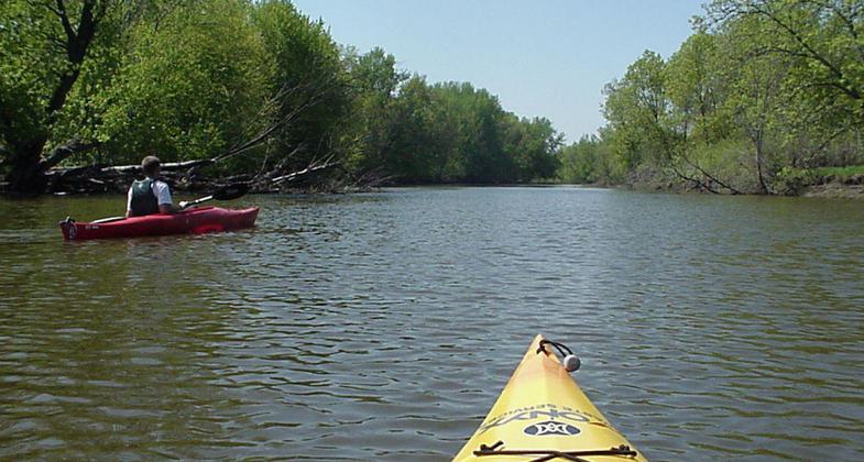
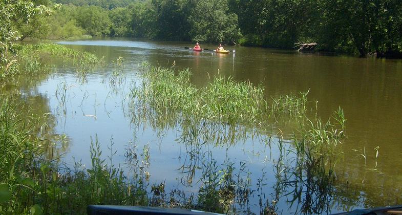
The Rock River Water Trail is a water trail of the Upper Mississippi River Region. The trail meanders for 320 miles from the headwaters above the Horicon National Wildlife Refuge in south central Wisconsin to the Mississippi River at the Quad Cities of Illinois and Iowa.

Location: From headwaters above the Horicon National Wildlife Refuge in south central Wisconsin to the confluence with the Mississippi River at the Quad Cities of Illinois and Iowa.
- States: Illinois, Wisconsin
- Counties: Rock Island, Henry, Whiteside, Lee, Ogle, Winnebago, Rock, Dane, Jefferson, Dodge, Fond du Lac
- Cities/Townships: Eleven counties and 41 municipalities in two states are given in maps in the Rock River Water Trail Plan.
The Rock River Water Trail is a regional water trail of the Upper Midwest, flowing 320 miles through two states from headwaters above the Horicon National Wildlife Refuge in south central Wisconsin to the Mississippi River at the Quad Cities of Illinois and Iowa. Traveling through five counties in Wisconsin and six counties in Illinois, the beautiful river meanders down a gentle gradient to safely carry the water traveler and recreational enthusiast alike past picturesque landscapes, natural wilderness areas, and vibrant urban riverfronts.
The Rock River Water Trail is of national significance for its great diversity and choice of landscape, vista, and recreation experience and for its ease of accessibility. The historical and cultural resources of the Rock River Valley and special river-focused events in many of the communities offer the water trail user an exceptional look at the Midwest landscape, culture, and history; thereby enhancing the water trail experience.
In the Wisconsin headwaters landscape sculpted by the advance and retreat of the last glacier is of geological significance as represented by the Ice Age National Scientific Reserve Unit at the Horicon Marsh and the unique drumlins, kettles, and moraines of Dodge and Jefferson Counties. The Horicon Marsh is an internationally recognized wetland and bird sanctuary.
The Ice Age National Scenic Trail crosses the Rock River at Janesville, Wisconsin. Further south the landscape transitions to the narrow valleys of the unglaciated region of Winnebago and Ogle Counties and, finally, to the prairie lands and savannahs of the sandy plain lowland of Whiteside and Henry Counties before the river ends its journey at its confluence with the Mississippi River.
Traveling through two states the Rock River Water Trail is usable everywhere and by everyone, whether a novice or experienced paddler. Over 30 percent of the 155 access sites along the water trail are accessible by persons with disabilities. The Rock River is within an hour's drive of the major urban areas of Chicago, Madison, and Milwaukee and is expected to provide water resources and green space to meet future demands for recreation and conservation.
The trail is a diverse recreational waterway with 22 dams and three river impoundments that form Lakes Sinissippi and Koshkonong in Wisconsin and Sinnissippi Lake in Illinois. Recreational uses include canoe and kayak paddling, motorized boats for pleasure, water skiing, fishing, swimming, and hunting; even sailboats are used on the large lakes.
Camping is available along the trail at over 20 public and private facilities. The US Department of the Interior, Bureau of Land Management, owns three river islands in Wisconsin, each of which is available to the water traveler for primitive camping.
The cultural heritage of the Rock River Valley is made rich from the contributions of aboriginal peoples, explorers, and early settlers and from the industrialists, agriculturalists, statesmen, and visionaries of more recent times: Woodland Indian villages and mound builders, Chief Blackhawk and the Sauk Nation, the travels of Abraham Lincoln, John Deere's blacksmith shop in Grand Detour and development of Wisconsin dairy agriculture by W D Hoard of Fort Atkinson. A youthful Ronald Reagan saved lives as a lifeguard on the river at Lowell Park in Dixon, Illinois.
Waterpower of the river drove industry that shaped the economy of communities along the river. The feeder canal at Rock Falls used water from the Rock River to power transportation along the historic Hennepin Canal, linking Chicago with the Quad Cities. The Yellowstone Trail and Lincoln Highway crossed the Rock River as the nation's earliest transcontinental highways. Sculptures such as The End of the Trail in Waupun and The Eternal Indian near Oregon exemplify a rich cultural heritage.
Today, a number of river communities make their riverfront destinations for residents and visitors alike. These communities serve as recreational centers that integrate the water trail, adjacent land trails, and urban bike and pedestrian paths with the cultural and historic center of the community.
The genesis of the Rock River Trail Initiative began in 2010 with a group of public and private partners from Winnebago and Ogle Counties, Illinois. On April 17, 2010, the inaugural paddle to officially establish the Rock River Trail was conducted in Illinois from Oregon to Dixon. The trail initiative organization is an Illinois not-for-profit corporation with a volunteer board and council.
The Rock River Water Trail Inventory, Analysis and Plan, prepared by the Rock River Trail Initiative Council, establishes the framework for the water trail. To date access sites and portages have been signed, campsites identified and all eleven river sections officially opened. The vision for the Rock River Water Trail has been enthusiastically supported by local communities and counties, and by the Wisconsin Governor's State Trails Council and the Illinois Greenways and Trails Council.
The Rock River Water Trail provides natural links to urban centers, rural areas, outdoor landscapes, and wilderness, and to local, state, and national trails and parks across two states. Recreational opportunities abound for residents and visitor with convenient and well-marked access points, well-designed use facilities, and safe and enjoyable conditions for a variety of water trail and river corridor activities. A river of opportunities for all interests!
Accessibility Information
No text provided.
Allowed Uses:
Boating, motorized Boating, human-powered SwimmingOther Activities
- Camping
- Fishing
- Heritage and history
- Hunting
- Ice skating
- Wildlife viewing / observation
Public Contact
Greg Farnham and Therese OldenburgRock River Trail Initiative
Information and Visitors Center
306 Dickop Street
South Beloit, IL 61080
[email protected]
More Details
- Elevation (low): --
- Elevation (high): --
- Elevation (cumulative): --
- Part of a Trail System? No
- Surface (primary): --
- Surfaces (additional): Rock, boulders, Rock, smooth, Snow or ice, Water, calm
- Tread Width (average): 0"
- Tread Width (minimum): 0
- Running length (minimum): --
- Tread Grade (average, percent): --
- Tread Grade (maximum):
- Running length (maximum): --
- Cross-slope (average, percent): 0
- Cross-slope (maximum): --
- Running length (maximum): --
- Certified as an NRT
Mar 10, 2013