Rocky Ridge Horse Trail
check with the trail manager for updated details before visiting.
Rocky Ridge Horse Trail
U.S. Corps of Engineers
Backcountry Trail
- Length
8 miles
- Elevation Gain
--
- Route Type
out & back
(1 review)
- Length
8 miles - Elevation Gain
-- - Route Type
out & back
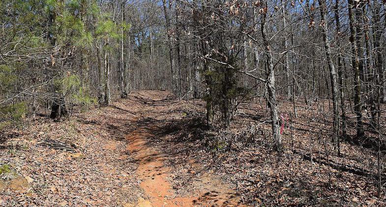
The Rocky Ridge Horse Trail along the northern side of Enid Lake, Mississippi. Photo by Fredlyfish4/wiki.

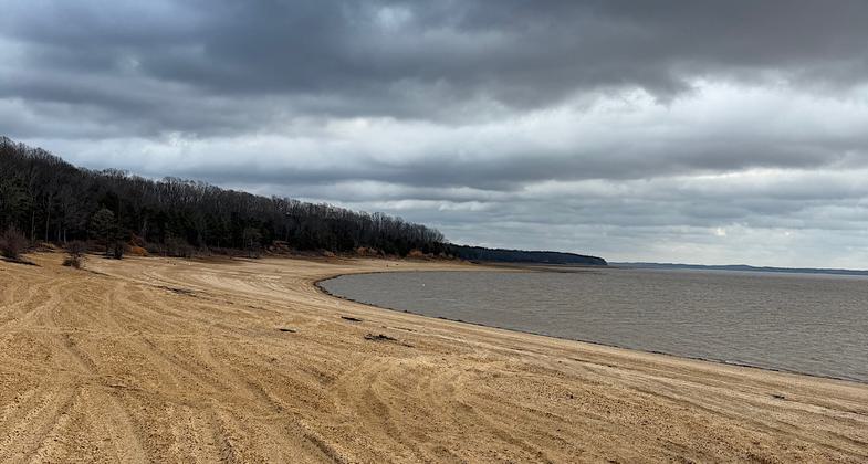
Nice lake access at beginning of trail

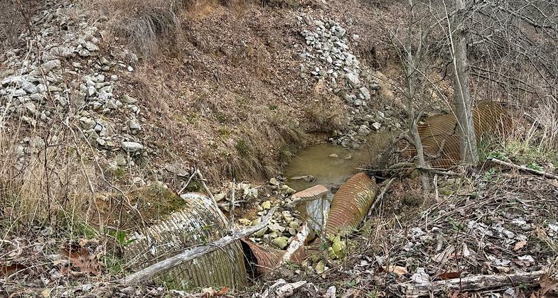
Massive washout less than a mile in, trail impassable

Location: Near Plum Point Recreation Area off I-55.
- States: Mississippi
The Rocky Ridge Horse Trail is a 9 mile equestrian and hiking trail located across from the Plum Point Campground. This trail runs long the shoreline and through upland and bottomland hardwood forests.
Accessibility Information
No text provided.
Reviews
Patricia Ellis
Massive washout within the first mile, trail impassable
There is a massive and deep washout within the first mile of the trail. It is impossible to get to the other side of this washout. Before the washout, the trail is pleasant, though badly eroded in sections. The very first part of the trail takes you to the lake before heading back into the woods. Were it not for the washout making hiking the rest of the trail impossible, I’d give the trail a three star rating since it is easy to follow and pleasant albeit eroded. Hiked/visited Feb 6, 2025
Allowed Uses:
EquestrianPublic Contact
US Army Corps of EngineersVicksburg District
Enid, MS 38927
Contact the trail manager for current maps and visiting details.
More Details
- Elevation (low): --
- Elevation (high): --
- Elevation (cumulative): --
- Part of a Trail System? No
- Surface (primary): --
- Surfaces (additional): --
- Tread Width (average): 0"
- Tread Width (minimum): --
- Running length (minimum): --
- Tread Grade (average, percent): --
- Tread Grade (maximum):
- Running length (maximum): --
- Cross-slope (average, percent): --
- Cross-slope (maximum): --
- Running length (maximum): --
- Certified as an NRT
Jun 28, 1984