Rocky River Reservation All Purpose Trail
check with the trail manager for updated details before visiting.
Rocky River Reservation All Purpose Trail
City, Town, or County
Frontcountry Trail
Urban Trail
- Length
13 miles
- Elevation Gain
--
- Route Type
out & back
(1 review)
- Length
13 miles - Elevation Gain
-- - Route Type
out & back
Massive shale cliffs rise above willows, sycamores, and cottonwoods as the trail winds through the Rocky River valley's deep floodplain forests, meadows, and wildflowers.
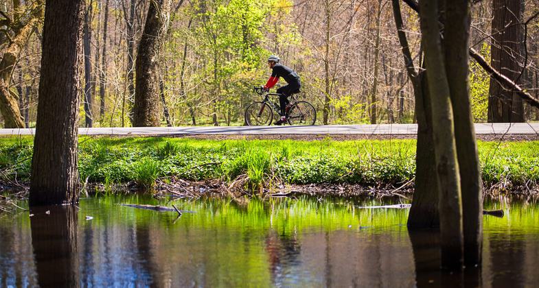
A very popular cycling route in Cleveland Metroparks. Photo by Kyle Lanzer.

Rocky River Reservation. Photo by Kyle Lanzer.

The Rocky River. Photo by Kyle Lanzer.

Location: W of Cleveland follows Rocky River from SR 10 N to Detroit Rd.
- States: Ohio
This paved trail stretches 13 meandering and mostly flat miles along the Rocky River. Tall shale cliffs rise steeply from the river and mature forests provide shade for the trail and habitat for animals and birds. A popular stop along the way is the Rocky River Nature Center, free and open daily with restrooms, water, and an outdoor bike repair stand. The trail connects to the next two reservations, providing 20 more miles of contiguous park trail leading the Ohio & Erie Canal Towpath, another National Recreational Trail.
Accessibility Information
No text provided.
Reviews
Willam Fader
Rocky River Reservation
The City of Cleveland has a gem of a trail called the Emerald necklace it's part of the Cleveland Metro Parks. Rocky river is just a part of the 30 trails they have to offer. From Wikipedia Referred to unofficially as the 'Emerald Necklace', the network of parks spans over 23,000 acres (9,300 ha) and includes over 300 miles (480 km) of walking, bicycle, and horse trails as well as numerous picnic areas, nature education centers, golf courses, and countless fishing spots.
Allowed Uses:
Bicycling Dogs, on leash Hiking/WalkingOther Activities
- Camping
- Fishing
- Wildlife viewing / observation
Public Contact
Cleveland Metroparks4101 Fulton Parkway
Cleveland, OH 44144
[email protected] • (216) 635-3200
Contact the trail manager for current maps and visiting details.
More Details
- Elevation (low): --
- Elevation (high): --
- Elevation (cumulative): --
- Part of a Trail System? No
- Surface (primary): Paved
- Surfaces (additional): --
- Tread Width (average): 72"
- Tread Width (minimum): --
- Running length (minimum): --
- Tread Grade (average, percent): --
- Tread Grade (maximum):
- Running length (maximum): --
- Cross-slope (average, percent): --
- Cross-slope (maximum): --
- Running length (maximum): --
- Certified as an NRT
Aug 18, 1975