Round Mountain
This information is a public record of the 1979 NRT application and may be out of date if it has not been updated by a trail manager --
check with the trail manager for updated details before visiting.
check with the trail manager for updated details before visiting.
Round Mountain
USDA Forest Service
Backcountry Trail
- Length
8 miles
- Elevation Gain
--
- Route Type
out & back
- Length
8 miles - Elevation Gain
-- - Route Type
out & back
This trail goes to the top of Round Mountain with beautiful panoramic views of the Cascades, Big Summit Prairie, and Lookout Mountain.
Location: Big Summit Ranger District, In Ochoko National Forest, starts at Walton Lake campground.
- States: Oregon
- Counties: Crook
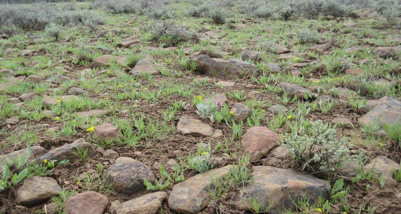
The trail climbs over the top of Round Mountain (at times steeply) and descends the other side to connect with Independent Mine Trail #808 near Forest Road 42. There are many open meadows, large stands of old growth ponderosa pine and mixed conifer forest. Water is scarce, so be sure to bring enough for your entire trip.
Accessibility Information
No text provided.
Allowed Uses:
Bicycling Dogs, on leash Equestrian Motorized vehicles, snowmobilingOther Activities
- Camping
- Snow, snow play general
Public Contact
Barbara SmithBig Summit Ranger District
P.O. Box 490
Prineville, OR 97754
[email protected] • (541) 416-6500
www.fs.fed.us/r6/centraloregon
Contact the trail manager for current maps and visiting details.
More Details
- Elevation (low): 5400
- Elevation (high): 6753
- Elevation (cumulative): --
- Part of a Trail System? No
- Surface (primary): Paved
- Surfaces (additional): Rock, boulders, Soil
- Tread Width (average): 12"
- Tread Width (minimum): --
- Running length (minimum): --
- Tread Grade (average, percent): --
- Tread Grade (maximum):
- Running length (maximum): --
- Cross-slope (average, percent): --
- Cross-slope (maximum): --
- Running length (maximum): --
- Certified as an NRT
Oct 18, 1979


